Monday, December 13, 2010

Mileage and mornings

When I woke up this morning at 5:00, it was 52° F.  But since that kind of weather is usually from out of town, it is transported to Denver on strong and steady winds.  So the first and last stretches of my run today were attended by a pretty good headwind.  Still, I'll take that over the sub-freezing temperatures I've been running in lately.  And it is such an encouraging, simple pleasure to turn a corner and find that the force which has been dogging my every step for the past few miles is suddenly to my back and helping push me along.

Since taking up running back in August, I've been working on pushing my mileage up in hopes of being in shape to run the Denver Marathon next October.  Earlier this month, I broke through the 10-mile mark for the first time, and I've been hitting that distance consistently ever since.

It is beginning to occur to me, however, that I am near a point where I must choose to either stop increasing my mileage or start running faster.  I don't have that much time in the morning to work out before going to the office, so continually increasing the amount of time I spend running isn't going to work.  But I started doing the math, and my pace would have to improve dramatically to make very much difference. I think I need to adjust my schedule and do a longer run on the weekend.

Sunrise, December 1st, 2010 
I've never been a morning person before, but even on non-running days, I've really been enjoying a little bit of quiet time before the rest of the family wakes up.  And on the days that I am out there running, it feels incredible to be able to experience the day breaking: the sun rising; the first golden rays of light illuminating the treetops, roofs, and the mountains.  I feel like I'm getting to tell the whole world good morning.

I pass lots of dog-walkers, kids on their way to school, and people driving to work.  I wonder if they are having the same experience, or if there is something about the physical exertion, the open air, or the fact that I'm out there voluntarily that somehow makes it more meaningful to me.  I'm certain, at least, that I'm not the only one who is in this state of awe.

Friday, November 12, 2010

Reflections while running on an Autumn morning

Waking before dawn in the dusk of the year,
I see bare cottonwood limbs reaching toward a cold, gray sky.
I see the newly-risen sun burning away
the mist that shrouds the earth.
I see the frost disappearing
from the golden leaves which blanket the ground.
And the winged silhouettes that rise above the lake,
which shimmers silver at first light.
There is more beauty to be seen in this world
than one man can attend.
I am drawn by the desire to stop to take in the scene,
but I quicken my pace to discover
what new wonder awaits around the next turn.

Sunday, October 24, 2010

The Stride in Littleton

I just got home from "The Stride", a charity run benefiting the Littleton school system.  I came across the event online, and since I had an errand to run on that side of town this weekend anyway, we decided that it would be good to get the family out to participate.  I signed up for the 10k option, after which we would all do the 1k Family Fun Run.

Refreshment between the 10k and the Fun Run

My wife and kids took advantage of the many activities going on while I was out running - there was face-painting, an obstacle course of sorts, and rope-jumping.  And they were there at the finish line to cheer for me.

Recruiters for the rope-jumping team

There was an hour and a half between the 10k start and the Fun Run start.  Unfortunately, that seemed to be just enough time my daughter to tire herself out, so we ended up walking nearly the entire 1k.  But at least we got to stick together and cross the finish line as a family.

On the 1k Fun Run

Something went wrong with recording the run on my phone - Cardio Trainer didn't actually start the workout when I told it to - so I didn't get as much data as I wanted.  But as near as I can tell, the map below shows the basic route.  I finished in 48 minutes, which is typical of the pace I've been keeping lately.


View Larger Map

Monday, October 4, 2010

Chicago's Lakefront Trail

My 33rd birthday has found me in the city of Chicago, traveling for work.  While I would prefer to be at home with my family, I'm trying to make the most of the situation.  I've been to Chicago a couple of times in the past, but have never had an opportunity to see much of anything which wasn't en route from my hotel to the office.

When planning this trip, I chose a hotel within easy striking distance of Lake Michigan.  Judging from the map, Lakefront Trail looked like a promising destination for a morning run, so that's where I headed.  It was just as lovely as I'd hoped it would be.

Lakefront Trail, Chicago
The weather was perfect, the sun rising over the lake was beautiful, and the lower elevation (ergo, increased oxygen) made me feel like I could run forever.  I didn't have time to test that theory, but I returned to my hotel feeling great.  My speed and distance were significantly better than any I've done in Denver.  I should get at least one more run in before returning home later in the week.


View Chicago Lakefront in a larger map

Friday, October 1, 2010

Die Flederkatze

When my 4-year-old daughter decides she likes something, she tends to obsess about it quite a bit.  I guess she gets that from me, mostly.  Right now she's into two things: cats (toys, not the musical) and The Tick (animated, not live-action).  She has also been going running with me every morning for a couple of weeks, now.

We just go around the block - about 0.6 or 0.7 miles - and we don't run the entire way.  We have what she calls "second goal points" to which we run, and then we walk for a little bit before running to the next point.  She says she doesn't want to run any farther than that.  Just around the block.  But she wants to run around the block every day for the rest of her life.

I don't know how long this will actually last, but I'm doing my best to keep her interested and to avoid putting pressure on her.  I do know that it's nice having a running partner, and our trips around the block make for a good warm-up before I go out for longer runs.

The culmination of these interests is that she likes to dress up as Die Flederkatze (a cat version of the hero, Die Fledermaus from The Tick) when we go running (as well as when she's just hanging out around the house).

Die Flederkatze
Not really visible in this picture is the tail she fashioned out of a sequined scarf.

She has also decided that we will all be cats for Halloween this year.  But while I do have a set of ears of my own now, thankfully she has not insisted on having me wear them when we go running.

Wednesday, September 15, 2010

Running off into the Sunrise

About a month ago I decided to try running my commute a couple of times a week.  While it worked okay, I'm not certain that it's practical for me in the long term.  It required leaving my laptop at the office for most of the week, which was something of a mixed blessing.  But at this point, I've more or less decided to commute by bike and reserve running for morning workouts.

The weather here in Denver has been really nice lately.  Overnight lows generally have been in the 50s and highs have been in the 80s.  It won't last long, but I'm enjoying it while I can.  This morning I got out for a run and had the pleasure of seeing the sun rise as I headed east back toward my house.


It can't be captured in a photograph, but there are moments when I'm overwhelmed with the beauty in the world around me, and I just want to throw my arms up in the air and sound my barbaric yawp over the roofs of the world.

Wednesday, September 1, 2010

Longs Peak

Some time back, while cycling on Peak-to-Peak Highway, I saw the signs pointing the way to the Longs Peak trail and ranger station.  I thought to myself that I should climb a 14er in the near future.  I mentioned this idea to my friend and coworker, Jim, who turned out to be planning a hike up Longs with his old buddy John, so he invited me to come along.

Most folks who want to hike up Longs Peak do so from the trail head off of Highway 7.  There are a few campgrounds along that route, but they were all full, so we made reservations to stay at Boulder Brook, accessible from inside the Rocky Mountain National Park.

John on the trail to camp
Friday afternoon we checked in at the ranger station for our back-country pass, and after supper at the Estes Park Brewery, we headed into RMNP.  We hit the trail from the Bierstadt Lake parking area and hiked about three miles to our campsite.  It was around 8 p.m. when we arrived, but we were able to get our camp set up before night fell.

I discovered early on that I would not have to worry about my camera's battery running out during the trip, because it was still on the charger at home.  That was disappointing, but my phone's camera takes decent pictures, so I didn't worry about it too much.

For one reason or another, I didn't sleep much at all that night.  Along with my camera battery, I also forgot to bring a pillow.  But a couple of shirts in my sleeping bag's stuff sack served reasonably well, so discomfort wasn't the main issue.  At any rate, when the alarm clock went off at 3 a.m., I was feeling none too rested.  We had breakfast, packed our day packs, and were on the trail by 4, hiking by the light of our head lamps and a waning gibbous moon.

Hiking in the dark is a fairly strange experience, especially when the return trip would be made in full daylight.  I could tell that we were going through some very pretty scenery and looked forward to being able to actually see it on the way back down.

Longs Peak viewed from the Boulder Field
We reached the Boulder Field as day was breaking behind us.  It was just after 6 a.m.  By 6:45 we had scrambled and rock-hopped up to the Keyhole - a landmark notch in the ridge which leads to the western face of the mountain.  The view of Glacier Gorge from there was beautiful.

From there on out, I got a good first taste of what it means to climb a 14er.  I didn't really know what to expect, but Longs Peak did not disappoint.  We traversed the ledge running south to the Trough, scrambled up, and were treated to some more fantastic views.  The next traverse is the Narrows, a ledge which goes eastward along the south face of the mountain.  And finally, the Home Stretch, which despite its cheerful name is the steepest, slipperiest pitch of the route.  Still, it wasn't too bad and was quite a bit of fun.
Jim on Longs Peak summit

It was around 8:30 when we reached the summit.  There are times when achieving a goal makes the effort to get there feel worth it.  But in this case, I felt like the effort was better than reaching the goal.  There are some nice views from up there, to be sure, but the top of Longs Peak is just a big flat area with a bunch of boulders strewn about the place.  It does make for a good place to sit, enjoy a bite to eat, and reflect on things for a while before heading back down.

The descent goes much the same as the way up.  I was beginning to feel pretty tired, and I knew it was a bad time to start getting sloppy.  And I didn't want to be the cause of any rocks falling on the folks down below, so I was being pretty cautious.  John later accused me of being much wussier at down-climbing than I was on the way up, which is probably a fair assessment.  But we made it off the mountain without incident, so I feel like any criticism along those lines is strictly academic.

As mentioned, part of what's weird about hiking in the dark is going back over the same trail in the light. I didn't really recognize much of the terrain on the way back, and my perception of time was altogether different than it had been earlier that morning.  So I had a constant nagging in the back of my head that we were going the wrong way.  But my hopes for wondrous scenery were fulfilled and helped take my mind off of my aching muscles and joints.

Valley below the trail back to camp
We had hoped to return to camp by noon, but it was about an hour later than that when we finally got back to our tent.  We had hoped to have time for some food and coffee before packing up and going the last stretch back to the car.  But there were other campers waiting for us to vacate, so we just broke camp as quickly as we could and got back on the trail.

The whole reason for striking out so early was to avoid the inevitable afternoon thunderstorms, and our timing could not have been better.  There was some light sprinkling while we were on the trail, but we were safe and sound by the time the rain began in earnest.  We stopped at Oscar Blues in Lyons for a late lunch, or early supper, depending on how you look at it.  By the time I was in my own vehicle driving home, I was thoroughly exhausted and feeling great.

Jeremy on Longs Peak summit

Monday, August 23, 2010

Decoding nutrition labels

I recently finished reading a 5-part series of articles called "Decoding Nutrition Labels," by Jo-Ann Heslin. While it isn't too difficult to work out how to read those labels on your own, these articles can help make it easier to assess the quality of packaged foods at a glance.
  1. Serving Size and Calories
  2. Ingredient List, Allergy Labeling and %DVs
  3. Limit – Fat, Cholesterol and Sodium
  4. You Decide – About Carbohydrate and Protein
  5. Eat More – Vitamins and Minerals

Tuesday, August 10, 2010

Commuter Cross-training

The company I work for has a program called Self-Powered Commuting (SPC), the name of which was the inspiration for the title of this blog.  The program encourages people to use some human-powered means of getting to the office instead of driving.  Participants accumulate stamps for each day we bike, walk, or whatever, and at the end of the year, the stamps translate into dollars donated to the charity of our choice.  This year, the company donated several hundred dollars to NARSAD on my behalf.

In the office where I work, we're having an SPC Week to promote the program, and since I bike to work every day, I figured I would take the opportunity to change things up a bit.  Today I ran to work instead of biking.  I've been intending to get into running for quite some time, so this was a great chance to stop intending and start doing.

It's amazing how the route I've ridden countless times takes on a whole new feel when taken on foot.  If the run home this evening doesn't kill me, this could be the start of something really fun.

Sunday, August 8, 2010

My first time up Mount Evans

Mount Evans is the closest fourteener* to Denver and boasts the highest paved road in the world.  So of course cyclists flock to the place to pit themselves against this monster of a climb.  A coworker recently planted the seed of the idea into my head, so this morning I got up and made my own assault on the mountain.

My goal was to ride from Idaho Springs to the top of the mountain in under three hours.  Having looked at the results for the annual race, this seemed like a reasonable expectation.

I headed out from a parking lot on the southern edge of town at about 7:50.  At 9:00 I passed Echo Lake and made a quick stop at the gift shop there for an extra bottle of Gatorade.  It is also at this point that you must stop and pay an entrance fee to ride up Highway 5, which leads to the summit.  The individual pass is $3, and for cars it is $10.

Many folks prefer starting at this point instead of down at Idaho Springs.  Doing so cuts the distance in half and removes a couple thousand feet of elevation gain.  I chose against this mostly to ensure that I gave myself the full Mount Evans experience.

By 10:00, I had reached the poorly-named Summit Lake (there is still a lot of climbing to do before reaching the summit).  And I arrived at the top well within my time goal.  The final riding time was 2:36, with a total wall-clock time of 2:46.

Feeling like King of the Mountain.
There were cyclists all over the place up there, and I chatted with a few of them before heading back down.  The camaraderie amongst cyclists always adds to the experience.  It was quite chilly, and I was glad that I brought a jacket and ear warmers for the descent.

It turns out that there is a reason for not paving roads at this kind of elevation very often.  Because of the severe freeze/thaw cycles, the asphalt quality was really quite poor, especially after Summit Lake.  It was less of a problem on the way up, but on my way down, the road and my saddle conspired to inflict some serious abuse upon my nether regions.  That, coupled with the automobile traffic, made the descent somewhat disappointing.


View Mount Evans in a larger map

I had entertained the thought of having my family come with me, letting them hang out in Idaho Springs and drive up to the top.  But it would have turned out to be more of a hassle than any of us needed, particularly when considering that I left the house around 6:40.  The mountains around here are notorious for having afternoon thunder storms, so I wanted to be out of there well ahead of any adverse weather.  Hopefully we'll be able to drive up there together some time soon.

* A fourteener is a mountain whose elevation exceeds 14,000 feet.

Wednesday, August 4, 2010

Riding with Lance, Gov. Ritter, and a few thousand fellow Coloradan cyclists

Yesterday the mediasphere was all abuzz with the news that Lance Armstrong and Governor Bill Ritter were going to be holding a press conference this morning (2010-08-04).  Lance posted it to twitter, but I heard it first from 303cycling.com.  After the press conference, we would all be going for a big bike ride.  I promptly requested the day off of work.

Early birds at the steps of the Capitol.
This morning I rode from my house, down the South Platte River trail, to the Cherry Creek trail, and up 14th Avenue to the Capitol Building, arriving around 9:15.  Folks had already begun to gather, though many, many more would be arriving over the next 45 minutes.

It was no big secret as to what would be announced.  Back in May, at the Road to Victory ride, Gov. Ritter said that they had been working very hard to bring international bike racing to Colorado.  So today's announcement just made it (more) official: the first Tour of Colorado Quizno's Pro Challenge will be held in August of 2011.  It will be a 7-stage, professional level bike race ridden by the same teams that we've seen ride the Grand Tours of Europe, the Tour of California, etc.  Quizno's is the headlining sponsor.  More details can be read in the article from the Denver Post.

Gov. Ritter speaks about organizing the race.
Lance Armstrong describes his inspiration for suggesting the race.
As promised, once the press conference wrapped up, everybody lined up on 13th Ave. and Grant St., at the location of the first Quizno's sandwich shop, for the group ride.  There were a lot of riders there.

The field of riders in front of me.
The field of riders behind me.
We rode out to Washington Park and back.  I recorded the ride on my phone using the My Tracks Android application.

View Ride With Lance in a larger map

There were riders of all levels of skill on all types of bikes. It was pretty great to be able to be there.

Saturday, July 31, 2010

Raising kids outdoors

I spent a great deal of time outdoors when I was a kid.  When I was 5 or 6 years old, living in Texas, I used to go squirrel hunting with my dad in a pecan orchard that belonged to one of his friends.  While living in Germany, our family did a lot of volksmarches and other hikes through the countryside.  Many of the places we lived allowed me to walk out the door and straight into the woods.  It was a pretty terrific way to grow up, and to the extent that I'm able, I want to pass that on to my children.

In many ways, it turns out to be easier said than done.  But I'm getting used to the fact that hikes are always slower with two kids in tow, and they never last as long as I'd like.  A mile is a long way for a four-year-old.  And Colorado can be pretty hot in the summer, especially for a 9-month-old strapped in a baby conveyance apparatus.  So in general, I'm really proud of my kids for the way they're handling it.  Sometimes, I even think they're having fun.

In early July, we went to the Rabbit Mountain open space near Lyons and did a one-mile hike.  The terrain wasn't easy for little legs, but it was really pretty out there.  We got to identify some flora and saw lots of butterflies and bees.

Rabbit Mountain Open Space

Twice this month we went to the Rocky Mountain Arsenal National Wildlife Refuge and walked around Lake Mary.  It's a very flat trail, about a mile long.  But at this time of year, the prairie landscape heats up quickly.  They have a great visitors' center with a museum which discusses wildlife, the Cold War, and the efforts to clean up the byproducts of the chemical weapons which were once manufactured at this facility.  They have an area set up for children to make paper crafts, which is a great way to cool off after a walk around the lake.

Craft area at the RMANWR

There is also an educational room with lots of animal skins, bones, and other things for kids to explore.

Bee tree at RMANWF

I believe that this Bee Tree allows them to locate their honey in O(log n) time.  The Butterfly Pavilion in Westminster has one just like it.  The bees enter and leave through the tubes running from the tree to the wall.

Today we went to Estes Park to go fishing.  We went to the Lake Estes Marina to rent rods and got everything else we needed there, including licenses.  There is a $5 fee to bring your vehicle into the recreation area, and it is possible to pay for that inside if you don't have cash to pay at the entrance.

Fishing at Estes Lake Marina

We didn't stay long and didn't catch anything.  The water was too choppy and it was after noon by the time we got there.  I had hoped to rent a kayak and take my daughter out on the lake, but time didn't allow for it.  My youngest started getting fussy and a storm was brewing to the west, so we packed up and called it a day.  But it was fun nonetheless, and I think we'll be purchasing our own gear to do some fishing closer to home.

Sunday, July 25, 2010

I rode 100 miles yesterday

The Sunrise Century was yesterday morning. I got up at 4:30, started riding at 6:40, and was done 5 hours and 43 minutes later (5:28 of actual riding time). It was a lovely ride, though the first half of the day was overcast and, at times, quite chilly. The folks who volunteered to help at the aid stations did a fantastic job. And the food at the finish line was great.

This was the first time I've ridden from Nederland to Ward - in the past I've always ended up going the other direction. It was just as brutal as I feared it would be, but enjoyable nonetheless.  I may be missing a few small details of the course (official description is here), but this is basically the route, starting at point A/G:


View Larger Map

My pre-ride breakfast consisted of maple & brown sugar instant oatmeal with dried mango & berry mix, cashews, peanut butter chips, chocolate chips, and banana slices mixed in. It probably would have tasted a little more... normal, shall we say, if I'd left out the dried fruit. It was quite good, anyway, and provided lots of energy for the ride. Off-hand, I'd guess it had about 800 calories.

Whenever I think about Detox tea, I always think of stoners preparing for job interviews. But I ended up with a box of the stuff and have been drinking it after long rides. It seems to help flush out the lactic acid from my system to help me feel less achy the next day. So I had a big glass of that stuff after I got home.

Thursday, July 22, 2010

More suburban wildlife

Bull snakes are quite common in Colorado, and this year there seem to be more than usual.  Earlier this week, I saw another one on the trail while riding to work.  It was probably around 4 feet long.

Bull snake on the bike trail

Bull snakes are pretty good to have around, though it can be alarming to come across one if you don't spot it soon enough.

This morning, as I sat drinking coffee, I saw a pair of foxes in my back yard.  They were pretty scrawny and were looking for food.  One of them came right up on the deck while the other stayed a little farther back.

A pair of foxes in my back yard

I had to chase them off so they wouldn't bother our cats.  I didn't know how they got into the yard, but I imagined having to open the gate to let them out.  That turns out to have been fairly naive, and as soon as I opened the back door, they had no trouble making their exit.  One leaped clear over the back fence, while the other scrambled through a gap where the fence is broken.

I had no idea that a fox could perch atop a fence like a cat.  But one of them did just that, once it got to the other side of my neighbor's yard.  It sat there watching me for quite a while.

Sunday, July 11, 2010

Weekend training rides

The last two weekends I've been trying to put in some more miles on my bike in preparation for the Sunrise Century on July 24th.  This has taken me on a couple of beautiful routes which have some overlap on the Peak-to-Peak Highway, being CO-7 and CO-72 between Estes Park and, roughly, Blackhawk.  

Before last weekend, I had only ridden up there once, and that was with a loaded-down touring bike on my first bike camping trip with my friend Jody.  It's funny how much the hills look different now than they did then.


July 5, 2010


View Larger Map

This loop starts in Lyons and takes CO-7 to Peak-to-Peak Highway.  There it heads south to Ward before heading downhill on Lefthand Canyon Drive and returning to Lyons on US-36.  It's a classic route in this area, so there's probably not much for me to add to what's already been said and experienced.  I get the impression, though, that most folks like to go up Lefthand Canyon rather than just descend it.  But I've never been all that concerned with doing things the way everybody else does.

When entering Lyons from the east, turn off of US-36 at the Post Office sign.  You will immediately encounter Sandstone Park, which has restrooms and a water fountain.  This is where I like to start.  Highway 7 is just a block or so west of the park.

The climb up CO-7 to Peak-to-Peak is long, but not terribly steep (5% or 6% in the steepest sections).  And it's absolutely beautiful, following the St. Vrain River through the Roosevelt National Forest.

Highway 7 out of Lyons

The town of Ward must have been settled by itinerant families from New Mexico, insofar as they do not like to bother with posting signs to label their roads.  But the turn for the post office is clearly marked, and that's the road you want if you're heading down Lefthand Canyon Drive.  Immediately after making that turn, I passed a place in the town of Ward which looked like it might be a hangout for roadies and a place to wait for straggling riding partners coming up Lefthand.  But I don't like stopping very much, so I didn't stick around to see what the place had to offer.

July 11, 2010


View Larger Map

This ride is nice for those with the capability of doing one-way routes.   In my case, it meant having my family drive me up to Estes Park, drop me off, and meet me in Golden a few hours later.

For the first few miles coming out of Estes Park, the road isn't very good.  But eventually the shoulder widens and the traffic becomes more sparse.  There are a couple of convenience stores along the way before you get to Ward.

Peak-to-Peak Highway south of Ward

There is a traffic circle shortly after descending into Nederland.  Taking the first right (highways 119 and 72, which overlap at this point) will keep you on course.  It also passes right by a visitor's information center which has a water fountain, restrooms, and maps.  Here I took my only rest stop for the ride while refilling my water bottles and checking with the attendant to make sure I knew where I was going.

The road that climbs south out of town is pretty bad (more traffic and a narrow, crumbling shoulder), but before long, Highway 72 takes its leave of 119 and turns left.  I hadn't been on that stretch of road before, and it was a real treat.  There is a nice downhill stretch running beside a creek and railroad tracks.  But the climbing isn't done until you get past Wondervu - with a name like that, you know the place is going to be on top of something tall.

CO-72 then rushes you down Coal Creek Canyon, which eventually opens up onto a beautiful scene of pastures and the western-most plains and a nice view of downtown Denver beyond.  Once the highway is out in the open, it intersects with CO-93.  A right-hand turn takes you over eight miles and a few hills to Golden.

When I drive to Golden to climb Lookout Mountain, I like to start my rides from the park along Clear Creek, so that is where I arranged to have my family pick me up.  While I waited, I sat on a bench and watched people floating down the stream in tubes and kayaks.

It's really only about 25 miles from Golden to my house, so I guess I could have just ridden home from there.  But the multi-use path along Clear Creek is frequently crowded and isn't always conducive to riding fast.  And I had really gotten myself in the mood for pizza.  So the family and I had the all-you-can-eat buffet at Woody's Wood-Fired Pizza before heading home.

Sunday, July 4, 2010

Intro to sports nutrition

I came across a good article, Pre-season nutrition for sports, which covers the basics of sports nutrition.  It starts off talking about using the off-season for weight loss and tuning your body composition.  But while the title suggests that this is the main theme of the article, it quickly moves into in-season dietary topics.  These include pre- and post-workout nutrition; hydration; and why high-protein, low-carb diets are not a good idea for athletes.

Friday, July 2, 2010

A Father's Journey - 100 marathons in 140 days for mental health awareness

The subject of mental health awareness and research is one which is near and dear to my heart.  NARSAD, or the National Alliance for Research on Schizophrenia and Depression, is a non-profit which is doing some great work to sponsor researchers looking for cures and better treatments for mental illnesses.

Their site led me to http://www.afathersjourney.org.  This man's daughter has been suffering from schizophrenia for at least 12 years.

In his words:
I would like to create awareness for the unfairness of mental illness,  how most people afflicted are really nice people and to raise substantial donations to hopefully help improve the quality of my daughters life.

My dilemma is how to create an event that would be interesting enough to capture peoples interest.  I'm not much of a singer or dancer and I can't do much in sports.

But I can run.  So on September 19, 2010 I plan to leave from Savannah, Georgia and attempt to complete 100 marathons in 140 days, crossing the country on foot and finishing in Los Angeles on February 6, 2011.

This event will be to benefit two organizations:  NARSAD, the largest charity in the world funding mental health research, and NAMI, the organization that supports families when they are dealing with challenges of having a family member or friend with mental illness.

What this father is doing is incredible, and his cause is worthy of support.

Sunday, June 27, 2010

Grand Canyon Bicycle Tour, Epilogue

Apology

This account has probably been somewhat more exhaustive than even people who like me pretty well are interested in reading.  But while researching the trip, I failed to find very much information on the Internet related to the routes I needed to take.  Many of the details were provided in the hope that what has been recorded here will prove useful to some fellow bicycle traveler in the future.

Getting Home

My family and I spent the next day touring the Canyon, and I took my daughter on a very short hike down Bright Angel trail.  My son and wife waited for us at the top.  On our way back up, we saw some mule deer.

On the Bright Angel trail

We were able to go back to the Tusayan ruins and see the museum.  While there, we also participated in an activity in which a park ranger taught us how to make split-twig figures.  These animal effigies were made by ancient canyon inhabitants and used in hunting rituals.

On Father's Day we left the Grand Canyon, retracing my route as far as Kayenta.  It was strange, after my slow trip by bicycle, to find myself hurtling along at terrific speeds through the desert.  West of Tuba City, we stopped at a dinosaur tracks site.  There we were guided by a Navajo woman and shown the footprints of several different types of dinosaurs.

In Kayenta, we headed north on US-163 into Utah.  This took us near Monument Valley and a number of other attractions.  The landscape was pretty impressive.

Near Monument Valley, Utah

That night we camped out near the town of Monticello, Utah, in the Manti-La Sal National Forest.  It was very nice there - much more green than I expected from the desert we had been driving through.  The dense undergrowth was home to many mule deer, and I saw one wild turkey hen.

Dalton Springs Campground, Manti-La Sal NF

The next morning we headed for Glenwood Springs, Colorado.  On the way, we stopped for lunch at the Moab Diner, and later visited a dinosaur museum in Fruita, Colorado.

Dinosaur museum in Fruita, Colorado

The overnight stay in Glenwood Springs was pleasant.  That evening we ate at the Glenwood Canyon Brewpub, and the next morning we spent an hour or two at the hot springs swimming pool.

The Rocky Mountains always make me feel like I'm coming home.  Usually when I return to Denver, whether travelling for work or to visit family, I'm coming from the east.  But even approaching from the Western Slopes, it felt great to be back in the familiar mountains of Colorado.  It was a beautiful drive along I-70 and it felt wonderful to be back home.

My family at the Grand Canyon

Retrospective

I was happy to discover that, of all of the equipment that I took with me which went unused, most of it was bike repair gear that I don't regret having packed.  The only thing that was really useless was my plate.  Since I wasn't cooking for more than just myself, it was much easier to eat out of the cookware.  There are enough cycle-touring packing lists published online already, but in the future I may decide to write about specific items that proved useful.

Riding through the desert wasn't nearly as bad as I thought it would be.  The air was dry and constantly moving over me while I rode, so my body's own temperature regulation did its job admirably.  The temperatures were frequently in the 90s, but I never felt hot while riding.  Still, plenty of water, electrolyte replacement drinks, and salty snacks were certain to have helped.

By all accounts, the "drunken Indian" warnings were legitimate, but not a problem for me.  The thing I'd been told to watch out for mostly were people driving drunk along the desert highways at night.  Since I wasn't riding after dark, there was no issue.  And I was told to make sure I was not visible from the road if camping in the desert, lest I be harassed by said drunken drivers.  This is a basic principle of stealth camping, but I had to admit that discouraging trespassers hardly seems like an unfair practice.

I went the entire trip without any mechanical problems to speak of.  Not even a flat tire.  Mysteriously, after we got home, my front tire went flat from a goathead even though I hadn't ridden it since it was stowed in our room at the lodge.  And naturally, my drive train was filthy.  I pulled the chain, cassette, chain rings, and idler/tension pulleys off and scrubbed everything down in the parts washer.  Now my bike is ready to take me to work on Monday.

Grand Canyon Bicycle Tour, Day 14

On the last day of my Grand Canyon Bicycle Tour, I woke early, had breakfast, and headed back to the rim to see the Canyon in the morning light.  There was a wildfire near the town of Williams to the south, so the air was somewhat hazy; and some clouds would have made for a better photographic opportunity.  It was still beautiful.

Grand Canyon at sunrise

I returned to my campsite to begin tearing things down and prepare to head to Grand Canyon Village.  While packing up my belongings, a man in his twenties from Zurich, Switzerland, stopped by to talk for a little bit.  Shortly thereafter, a slightly older man from Stuttgart, Germany, came by to chat.  The latter is a 30-km/day bicycle commuter and had flown into Tennessee before driving to Arizona.  They were both very nice, and I wondered if Europeans are generally interested in bicycle touring.  I did find it strange that I didn't see any other bike travelers at the park while I was there.

The 25 or so miles to Grand Canyon Village were pleasant, with many scenic overlooks and some Tusayan Indian ruins to serve as diversions.  The museum at the ruins opens at 9:00, so I wasn't able to go in there yet.  The road wasn't as flat as I had imagined it to be, but none of it posed any great difficulty.

A series of small walls at the Tusayan ruins

In time, I made it to the lodge where we had reservations for the next two nights.  Check-in time wasn't until 16:00, so I arranged to store my bicycle there until later.  During my ride through western New Mexico and Arizona, I'd had a couple of people ask if I was part of of some Ride or Cruise, variously, Across America.  I wasn't sure exactly what it was, but I had failed to cross its paths with the group, whatever it was.  The bellman at the lodge confirmed that it was the Race Across America, and I rather wish that I had been able to see them.

I had an early lunch at the lodge's cafeteria, and then set out for the Bright Angel trailhead, just a short walk away.  I wasn't prepared for a major hike, but I really wanted to get below the rim a little bit, and it was a great way to spend the time waiting for my family to arrive.  I only went as far as the first rest area, 1.5 miles in.  I then hiked back up the trail, maintaining a quick pace so that I'd at least feel like I'd had a decent workout.

Grand Canyon from 1.5 miles down Bright Angel trail

Looking back at Bright Angel Trail

After the hike, I wanted to see what else Grand Canyon Village had to offer, so I got on one of the free shuttles and rode to Market Plaza (ate more food) and the Visitors' Center.  I was still in my cycling clothes, and after the hike, I'm sure I was not the most pleasant neighbor to have on the bus.

By the time I made it back to the lodge, I only had to wait a few minutes before I was able to check in.  I dropped my bike off in the room, quickly changed clothes, and waited outside until my wife and kids drove up.  It was great to see them, and though I had talked to them pretty regularly over the course of the past two weeks, I felt like I had so much to tell them that I would never shut up.

View Larger Map

Grand Canyon Bicycle Tour, Day 13

After I got up and got things ready to go, I spent some time talking to the minister of the church which had served as my home the previous night.  We talked about their ministry with the Indians in the area - Hopi and Navajo - and a little bit about the traditional beliefs of those groups.  I was curious to discover whether the pacing native I saw from the ditch was performing some kind of ceremonial act.  What I was told was that if there was not a crowd, it was probably not an official ceremony.  Religion is a community practice for the Navajo.  But they sometimes say personal prayers to the four cardinal directions, and I think it's possible that this is what I observed.

Either that, or it's so boring in the desert that some people just walk back and forth for entertainment.  I wouldn't be surprised either way, I guess.

I got on the road around 7:00.  After a very short stint on US-89, I turned onto AZ-64.  This was one of the nicest roads I've ever ridden, as far as the quality of the pavement goes.  The shoulder was consistently nice and wide, well-paved, and clean.  And the ride was otherwise very pleasant as well.  It was all uphill, but the grade was not too severe: perhaps 5% most of the time, with a few short sections steeper than that.  And most importantly, there was only the gentlest of breezes.  The scenery was lovely, as the Little Colorado Gorge cuts dramatically into the plain of the desert.

Little Colorado Gorge seen from AZ-64

Kaibab National Forest would have been a nice place to camp, had I made it there at an appropriate time.  But while the climb up to GCNP was enjoyable first thing in the morning, it might be less pleasant at the end of a hard day of riding.

Entering Kaibab National Forest, south of GCNP

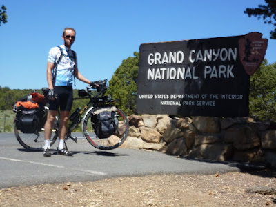
At last, at 11:45 I reached the Grand Canyon National Park.  It's difficult to tell from the photo that I took beside the sign, but I was positively beaming.  Oddly, the road's shoulder narrows upon entering the national park, but there wasn't too much traffic, and the riding was not bad.

Entering Grand Canyon National Park

I had heard that the National Park had a campground just for cyclists and hikers, but the gate attendant to whom I spoke didn't know anything about such a thing.  What she could tell me was that the campgrounds at Grand Canyon Village were full, but the first-come, first-serve sites at Desertview still had openings.  And it was right up the road from the gate.  I paid the $12 personal entry fee (it's $25 for a car) and went straight to the campground.  This was the first campground I'd seen with a self-service pay station which accepts credit cards, which was good news for me, since I didn't quite have enough cash to cover the $12/night fee.

As soon as I had things in order at the campsite (around 12:45), I headed for the canyon rim.  It was everything that I expected it would be.  I found a rock to sit on for a while, and as I reflected on everything I'd been through so that I could be in that very spot, I got a bit choked up.

Grand Canyon as seen from Desertview

I had lunch at the Desertview snack bar.  It was unsurprising, both in terms of price and the food selection.  But I had quite an appetite and had to keep a tight reign on myself to avoid grabbing one of everything.  I did grab one of each of the fresh fruits.  Fresh fruits and vegetables were rare while I was on the road.

Exploring the Grand Canyon

I'd been seeing a group of volunteer workers around Desertview and ended up talking to a couple of them.  They were removing noxious weeds from the area to help protect the native and less aggressive species.  There were also signs in place encouraging people to avoid bringing in non-native plants via seeds stuck in dirty shoes and vehicles.

After relaxing a bit around the campsite, I returned to the rim that evening for a sunset talk by one of the park rangers.  Ranger Elyssa, who is also a classical percussionist, spoke to us about soundscapes - the sum of all things audible in a given area - and how they should be treated as natural resources to be preserved just as we try to preserve the landscapes.  It was an enjoyable talk and included a performance of a movement from John Cage's 4'33" (a composition of ambient sound and no notes).

Grand Canyon in the evening light

I was absolutely thrilled to have reached my destination.  It was an excitement matched only by my anxiousness to see my family the next day.

View Larger Map

Grand Canyon Bicycle Tour, Day 12

I woke up in my room at the Anasazi Inn feeling refreshed and optimistic.  I had about 143 miles left to go, but my official plan was to make it to the Kaibab National Forest just south of Grand Canyon National Park.  The next day would then be an easy ride to Grand Canyon Village.  This was not to be.

Mornings had typically been calm, even if the wind picked up later in the day.  But by the time I got on the road, the wind was already blowing steadily out of the west.  It got worse throughout the day, until every pedal stroke was dogged by that incessant headwind.

I stopped at Elephant Feet, a rock formation near Tonalea/Red Lake.  There, some Navajo women had set up tables where they were selling beaded jewelry.  I talked to them for a little while and picked up some gifts for my wife and daughter.  A little way down the road, Tonalea has the only convenience store I recall seeing between Tsegi and Tuba City.

Elephant Feet near Tonalea, AZ

I had hoped to reach Tuba City around noon, but the going was slow and it turned out to be a little after 13:00 before I would arrive there.  Tuba City turns out to be an almost exact copy of Kayenta as far as services and restaurants are concerned.  There was another Pizza Edge there, but on this day, I decided to eat at a Chinese restaurant called the Golden Rice Bowl.  The food there wasn't great - roughly on par with Panda Express - and I got the feeling that I was interrupting the employees' social time.

I talked to my wife for a little bit before getting back on the road.  I was wary of riding farther in that wind, which was a sustained 20 miles per hour when I stopped for lunch.  But my wife affectionately told me to suck it up and get back out there.  Tired as I was, I still believed that I could make it to Kaibab that afternoon.

Leaving Tuba City turns out to be one of the worst decisions of the trip.  The other big mistake was failing to refill all of my water bottles before leaving.  I thought I had enough to make the 26 miles to Cameron.  The wind had picked up even more.  My progress was painfully slow, averaging somewhere around 7 miles per hour.  At one point I had to dismount and walk my bike for the first time on this trip: the wind just made it impossible to control my bike, and I was nearly blown into traffic.

Two hours later, after turning south from US-160 to US-89, I had to stop at a roadside native crafts stand and ask for some water to get me the rest of the way to Cameron.  A tourist customer there obliged me while the Navajo woman working there told me that Cameron was only 14 miles down the road, and I could get water there.  I told her that I knew that, but that it would still take me two hours to get there.  The extra water given to me there helped greatly, and having enough to drink was no longer one of my concerns on that stretch of road.

Junction of US-160 and US-89

The wind, on the other hand, continued to be my nemesis.  It became primarily a cross wind once I got onto US-89.  Through several stretches I was blasted by loose sand blowing across the road.  I had to dismount again, as the sandstorm was blinding me.  And the shoulder on this highway is very inconsistent.  Frequently it is narrow and half-occupied by a rumble strip.  I had to ride in the traffic lane, but the many tour buses and RVs didn't always want to make room for me.  Controlling my bike was a major struggle, and on several occasions I was inches away from being struck by a passing vehicle.

By the time I got to Cameron, I knew I needed to get off of the road for the day.  I think there is an RV park and lodge in town, but I didn't have much hope for there being any vacancies.  So I stopped by the local post office to inquire about churches in the town.  Somehow it is a time-honored tradition for churches to take in bicycle tourists, allowing them to pitch their tents on the church grounds for the night.  The post office was closed, but a local Navajo man came in to check his PO box.  I asked him about churches, and he offered to put my bike in the back of his truck and drive me to the nearest one.  It was only just up the road, but I gratefully accepted the offer.  Once the man figured out that all I really needed was a place to put up my tent, he said that I could have done so in his own yard.

I won't go into detail about exactly which church it was where I stayed - after all, they're trying to run a church, not a youth hostel.  But the minister and his wife were very kind, and I didn't feel like I was able to thank them enough for their hospitality.  I used the hose outside to rinse off as much of the sand from my skin as possible.  When it became evident that there was no place where my tent would be sheltered from the wind, the minister offered to let me sleep inside the church building.  The accommodations there were almost as nice as a motel, but that I had to sleep on the floor.  There was a bathroom where I was able to clean myself up a bit and a kitchen where I was able to prepare a hot supper.

Camping upstairs in a church

Treacherous as it was, I made good progress for the day - about 85 miles.  And even though I didn't quite make it to Kaibab, I had set myself up well for the following day's ride.

View Larger Map