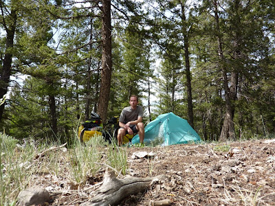
San Isabel National Forest, south of Trout Creek Pass
It was during this descent that I passed the first bicycle tourists that I'd seen on the trip. One was a lady with a trailer, and later I passed a pair with a full set of panniers. They all were on their way up in the opposite direction. A friendly smile and wave works wonders against the loneliness of being on the road.
Soon thereafter, I entered the Arkansas Headwaters Recreational Area. This is an area which was of particular interest to my father, so I pulled off at the Collegiate Overlook to, well, look over the valley where the Arkansas River begins its journey to the Mississippi. The view was amazing.
View from AHRA, Collegiate Overlook
I'd thought about detouring to Buena Vista, since I'd never been there before, but I decided to go to Salida instead. The wind did not let up, and was uncharacteristically coming from the south, slowing my progress considerably. But I made it to Salida in time for lunch. Before eating, I stopped at Absolute Bikes to look around and have my bike examined by a mechanic. The chain had started squeaking, and there were a couple of other things that I wanted checked out. The mechanic there turned me on to a couple of things: Dumonde Tech chain lube and Mamma D's deli. I had a good lunch, hung out for a few minutes on the banks of the Arkansas River, and headed back for US-285.
Aside from the persistent headwind, Poncha Pass (9010 feet) was the riding highlight of the afternoon. But it didn't pose too much of a problem. I reached the summit at about 15:50.
The summit of Poncha Pass
After making it over the pass, I took the first forest access exit I found and set up camp at a dispersed site for the evening. It was just inside a bunch of spruce and aspen trees on the edge of a large field. Cows were at pasture nearby, and I got to listen to them throughout the night.
View near my campsite
I thought at the time that I was still in the San Isabel NF, but looking at maps now, it appears to have been the Rio Grande NF. And the access road I took merely stated that it was public land, so it's possible that I wasn't quite in the national forest at all. But I passed other campers on my way to the site that I chose, so wherever I was, it was fine.
Home for the night
At this point, I was back on my planned route after the detour to avoid Elevenmile Canyon. It was a bit of a shame, really, that I didn't get to go to Elevenmile Reservoir. I don't know if there was anything there, but it looked inviting on the map.
View Larger Map


Hooray! I'm glad you are giving us a full write-up. I envy you taking the trip and am excited to hear what happens next...
ReplyDelete