Saturday, July 14, 2012

A foot in two worlds

"A foot in two worlds" is kind of an imprecise cliché. "One foot in each of two worlds" would be more accurate... But I digress.

It's kind of disheartening how quickly reintegration can happen, and the experience of just a few hours ago gets shoved into the box of distant memories. Even last night as I was making camp, the day's efforts on the mountains seemed much further in the past than they were. Maybe that's why it is so important to keep on doing things as often as possible: trying to keep that feeling of adventure alive. Or maybe it is so I don't feel like I'm going to spend the rest of my life talking about that one time I did something that, for an ordinary guy like me, was extraordinary.

I like to take a journal with me on some of my adventures. The passage above was written on July 5th, the evening after I got home from my short backpacking trip in Indian Peaks. The "reintegration" it talks about is, of course, the return to normal life, its mundane duties, and a society that's disconnected from my most emphatic experiences.

I think I have a bit of a problem: when I'm out hiking, climbing, running, riding, I feel more connected to life as it should be. I am in the moment. I am at home. Everyday life is starting to feel less and less like Normal and more like an interruption from what I'm supposed to be doing.

Let's say there are two types of adventurers. The first we'll call Weekend Warriors. These are the people who have more-or-less typical Monday through Friday, 9-to-5 jobs, and during their free time they go out and immerse themselves as well as they can in their outdoor pursuits. The second type we'll call Dirtbags. This is the full-time tribe of devotees who eschew the draw of civilization and worldly goods, sacrificing modern comforts in favor of fulfilling their passion. Some of these people are professionals and get paid or sponsored to share their experiences with the rest of us. But however glamorous the lifestyle may appear at first glance, very few of these people become wealthy by their endeavors. They do what they do out of love of their trade, even if it means living out of a van for much of the year.

I'm firmly entrenched in the former camp. I have a day job, a family, a home in the suburbs. It isn't a bad life. To the contrary, there are many things to love about the comforts and privileges I enjoy. But it isn't always easy bouncing back and forth between adventure and what I often perceive as the mundane.

The trouble I have after returning from an adventure of any kind is that the feeling of freedom is so quickly subdued. By the time I've driven from the mountains back to my house, everything I've experienced has begun to fade from the forefront of my mind into the vaguer pool of memories. And I'm afraid that I've become addicted to the feeling of new memories being forged rather than old memories being remembered and relived.

What can be done about this?

A common pitfall is to dream of all the things that can be done after retirement. Once we've fulfilled our obligations to society through a lifetime of productivity, we will be free to pursue whatever adventures we choose without the leash that leads us back to "normal" life. It is said that youth is wasted on the young. And I believe too often the inverse is also true: retirement is wasted on the old. If I do nothing now, I'll be in no shape to do anything when I'm old.

Dropping out is another tempting fantasy: quit the job, sell the house, live the vagabond life of a Dirtbag. Barring some drastic life change being imposed from the outside, I think that decision has to be made earlier in life. It wouldn't be fair to my family to force them into a lifestyle that is decidedly more attractive to me than to them.

All I can do is play the hand I'm dealt: continue to appreciate and enjoy the opportunities I have to experience the wonders that surround me, whether they're found in the wild places of the world or right here at home. Dissatisfaction is a slippery slope that can only rob me of the gifts I have been given or earned. And after all, not only am I always forging new memories - some of the most precious kind - with my family, but I am playing a part in molding the memories my kids will (hopefully) cherish in years to come.

Thursday, July 5, 2012

Independence Days in the Indian Peaks Wilderness

The rest of my family has been out of town for a week and a half, now. C took the kids to visit their grandparents in Michigan. And with some extra time off work for the 4th of July, what better way to spend Independence Day than completely on one's own in the middle of the wilderness?

I'd been poring over my map of Indian Peaks Wilderness Area, hoping for a nice 3-day route to jump out at me. Part of what I saw there amid the contour lines and trail markings is going to have to remain a project for the future. But I was able to make most of it happen.

Tuesday morning I got up really early. Unnecessarily early, even for a hiking day. My camping permits had been secured. The cats were boarded at the vet. I had rigged up an automatic watering system for the planters on the deck. Our fish was in the care of our wonderful neighbors (along with emergency information, should I fail to show up to get the fish back). The house was ready to take care of itself for a few days. My backpack was ready to go. So even though I poked around quite a bit, I was out the door and on my way to the mountains pretty early.

Long Lake

I arrived at the Long Lake trail head in the Brainard Lake recreational area some time around 7:00. Donning my pack and trekking poles, I set out for Pawnee Lake, just beyond the like-named pass over the continental divide. It's a short hike, maybe 6 miles, but beautiful and sometimes strenuous. I still had much of the day before me when I got to my destination for the first night.

Pawnee Lake

Upon arrival at the lake, I met a guy named Joel who had camped there Monday night. It was his first time backpacking, and Nature initiated him into the ranks by drenching him with rain. Taking that information into account, I sought as well-protected a camp site as possible. It was of particular importance to me, as I brought only a tarp to serve as improvised shelter.

After sitting by the lake for a time, having a snack and studying my route for the next day, I scouted the area. Fortune smiled upon me, and a perfect place to bed down for the night peeked out at me from beneath a large rock outcropping.

My camp site for the night of July 3rd.

Having made my sleeping arrangements, I lazed around for the rest of the day, exploring around the lake, reading, resting. There were tons of wildflowers in bloom, and everything was absolutely gorgeous.

Columbines in bloom.

It did rain for a while that afternoon, but my equipment and I stayed perfectly dry in our natural cubby. It was surprisingly comfortable, too, if I laid in just the right way. I woke up the next morning feeling well-rested. While I cooked my breakfast, bats flitted about to catch the plentiful mosquitoes hatched in the marshy area just below my nest.

The hike back up Pawnee Pass was a fine eye-opener first thing in the morning, but I made it up without too much trouble. The west side of the pass is pretty bad, as far as maintained trails go. The rock near the top is unstable and likes to slide out from under you.

The west side of Pawnee Pass, being the notch just left of center.
A white-tailed ptarmigan on the trail west of Pawnee Pass

From the top of the pass, I headed north to Pawnee Peak. I encountered another hiker who had gotten an early start from the trail head that morning. He said he was going to go up Mount Toll before heading home, but he must have lingered on Pawnee for a while, because I didn't see him again after I left its summit.


The south ridge of Mt Toll, viewed from Pawnee Peak


The south ridge of Toll is a straight-forward hike. Nothing else about that mountain can make any such claim. I wasn't prepared to descend the north face, which probably would involve rappelling, but I had read about a so-called social trail that skirts the west side and brings you to the saddle between Toll and Paiute. My first attempt to find that trail was abortive. After making it part-way, the route dead-ended. So I went back to the ridge, descended a little more, and found an entrance to the "trail" marked with a cairn.


Entrance to the western traverse around Mt Toll. There is a hard-to-see cairn right in the middle of the notch.

I stowed my camera for the sometimes-harrowing descent down a steep, crumbling gully, so I don't have any more pictures of the route. At the bottom of the gully, I found reason to believe that if I had gone a bit farther down from Toll, there would have been a better way to get through the first part of the traverse. But note that I'm not really recommending this route to anyone. Even without a large backpack, it isn't really the safest place to be. But if you want to get from Toll to Paiute without technical climbing gear, it's really your only option.

Approximate route traversing the west face of Mt Toll. The blue route is the one I took. The green section is based on speculation. The red is a no-go.

From the saddle, I down-climbed the east side to avoid an ice sheet (yes, even in July), but it ended up causing me to lose more elevation than I'd hoped. I cursed myself for not just climbing up and over the prominence on the ridge, but going down seemed like the safer option at the time.

Paiute Peak, viewed from the south. When viewed full-sized, a hiker can be seen atop the left-hand part of the summit.

As I approached Paiute, I saw a small group of big-horned sheep, with two little lambs playing rambunctiously among the rocks. I went as slowly and quietly as I could, but they disappeared down the west face of the ridge before I got very close.

Bighorn sheep just south of Paiute Peak

It was only around noon by the time I got to Paiute's summit, but I was feeling drained. I certainly had no energy for scrambling around in places where a mistake would carry mortal consequences. Fortunately, the ridge between Paiute and Audubon is no such place. Relatively speaking, anyway. So I made my way up the west ridge and over to Audubon's west side, where I joined the trail I had descended the previous time I went up Audubon.

Audubon's west ridge, viewed from the south of Paiute

I passed a couple of hikers who were also descending - they wondered where I had come from, given that there was nobody on the summit when they left. And with it being past 14:00, I was a little surprised to see a handful of people on their way up the trail.

A cairn along Audubon trail. Things were much greener than when I was there in June.

It would have been easier for me to just follow the trail back to my truck, but that wouldn't be much fun. And anyway, I had a camping permit for two nights, and I didn't want to waste it. So I turned north where the Audubon and Beaver Creek trails intersect and made my way back into my designated camping zone. Probably 1.5 miles from there, just a little below tree line, I found a spot where a brook ran near the trail, and just up the hill there was a clearing in the spruce trees where I put up my shelter for the night.

My camp site for the night of July 4th.

It was an overcast night, but it didn't rain. The full moon shone through gaps in the clouds from time to time, but even when it wasn't visible, its light reflected off of the clouds and kept it from getting very dark. Even as exhausted as I was, it was a disappointingly wakeful night. But I kept forcing myself to go back to sleep until I woke for the last time at 5:00. Since it was such a short distance back to the trail head, I had thought that I would just hang out for a while and finish the book that I brought with me. But the clouds that had persisted through the night began to threaten rain, so after breakfast, I packed up and was on the trail at 6:40.

On my way down, just after the first switchback below the intersection with the Audubon trail, a large buck with velvet antlers bounded across the path. Apart from the sheep at Paiute, it was the first large animal I'd seen out there, so I snapped a few pictures before moving on.

A buck near the south end of Beaver Creek trail

I began to see the morning shift of hikers on their way up the mountain. And just before getting to the parking lot, the trees opened up for a last good view of Pawnee, Toll, and Audubon. A last view for this trip, anyway.

Pawnee, Toll, and Audubon

So that's how I spent my Independence day: hiking through some of the most beautiful wilderness anywhere, sleeping in a cave, summiting four of the named Indian Peaks. It was my first time camping without a tent, and while luck had plenty to do with its success, I think a tarp may be the way to go from now on. It was also my first field trial of a home-made alcohol stove (made from a cat-food tin) and wind screen (made from soda cans I found). Those also worked quite well.

When my nephew and I were on the Appalachian Trail back in May, one of the many conversations about food involved burritos. So I decided to see what I could do about making some burritos on the trail. This was also a pretty good success. Instant rice, dehydrated refried beans, and some whole-wheat tortillas I packed in a freezer bag with a poster board backing to keep them from getting crushed. The burritos could have benefited from some nutritional yeast sauce and salsa, but when you've worked up a major appetite hiking all day, such luxuries are hardly required.


View Indian Peaks, July 3 - 5, 2012 in a larger map

Friday, June 29, 2012

Mmmm, breakfast! Oat bran with chocolate, almonds, and coconut

I recently picked up some oat bran from the supermarket so I could see how it compares with normal rolled oats as a breakfast cereal. After all, oat bran has more protein and fiber than oats, and fewer calories per gram. After having it several times over the past two weeks or so, it's safe to say that oat bran is going to be kept in stock in our pantry.

It could be argued that oat bran is more highly processed, less "whole", than rolled or steel-cut oats, but I'm not going to let that dissuade me from eating it.

So far, my favorite way to prepare oat bran is with cocoa, almonds, and coconut. It has a taste and texture that falls somewhere between candy bar and cake batter. But of course, it's much better for you than either of those things.

  • 1/4 cup (a little bit heaping) oat bran. You can get this in bulk at Sunflower (cum Sprouts, anon) or other health food stores.
  • 3/4 cup water. It's best to use imported distilled artesian well water. Just kidding. Use the tap.
  • ~ 1/4 teaspoon salt (about 4 or 5 good shakes)
  • 2 tablespoons cocoa powder
  • 1 oz. raw almonds (about 24 pc.), coarsely chopped. Also available in bulk.
  • 1/4 cup finely shredded coconut. I use some kind of organic, unsweetened, reduced fat stuff, so, you know, I'm sure it's really good for you.
  • 1 tablespoon blackstrap molasses.
  • 1-2 teaspoons Truvia or other sweetener, to taste.
  • ~ 1/4 cup almond milk

Put the first three ingredients into a fairly large soup/cereal bowl. Cook in a microwave on high for 3 to 3.5 minutes. The oat bran and water are actually measured since it only takes one measuring cup, and if you do the oats before the water, the measuring cup is clean when you're done. Also, if you get the ratio wrong the result will either be too pasty or too runny. As always, everything else is usually just kind of eyeballed, though I did measure that stuff out too one time, just to make sure my estimates are close to accurate.

Mix in the remaining ingredients except for the almond milk. Once everything else is well combined, add just enough almond milk to smooth out the texture. This also has the effect of cooling everything off so that you don't burn your mouth trying to eat the piping-hot oats. Because obviously waiting around for it to cool on its own is out of the question.

You may have noticed that this recipe follows much the same pattern as my fudge brownie oatmeal. That's not surprising or coincidental. I love the flavor combination of blackstrap and cocoa. And I don't like doing anything complicated like turning on a stove when I first wake up in the morning, so if a hot breakfast isn't coming from the slow-cooker, it has to come from the microwave. That's unpopular in gourmet circles, but I'm much more the pragmatic type.

I hope you enjoy, if you give this a try, and that it will fuel some kind of awesome adventure. Or at the very least, give you a nice happy feeling before going about your daily grind.

Monday, June 18, 2012

Was that Stupid or What?

Somehow I grew up without ever learning how to ride a wheelie (or manual, for those pedants out there) on my bicycle. I've decided I need to correct that particular oversight. So on my ride to work, while on one of the somewhat secluded sections of path, I've been trying to practice a little bit.

Usually I don't pull up hard enough, so the front wheel rises a little and drops right back down to the ground. Obviously the corrective measure is to pull harder. So I pulled harder. So hard, in fact, that the bike went over backwards, and I didn't make the bail-out. The result was a predictable case of road rash.

Road rash.

I'm not very spry, graceful, or good at things that require balance, so I knew this was going to happen sooner or later. It's probably why I didn't learn to do this as a kid.

In the days since I took that spill, I've had a number of people ask about it. The conversation usually goes something like this:

Them: "Did that happen on your bike?"

Me: "Yeah."

Them: "Were you just being stupid, or ..."

Me: "Just horsing around."

I know they're concerned that I may have been hit by a car or something, and I do appreciate that. But it gets me thinking about the alternative. Is a one-person accident necessarily the result of being stupid?

I say that in general, there's nothing stupid about trying to do something you've never done before. And a lot of times trying comes with a certain amount of risk. So you're going to take a hit now and then. Does that mean that the pursuit isn't worthwhile? I don't think so.

This incident came hard on the heels of another small scrape I got while bouldering. I got myself into a position where I had to put a knee down on the rock to make it up onto a bit of a ledge.

My kids are young enough to be impressed by the smallest of injuries. If I come home and they show me a skinned knee, the first thing I ask is, "Did you get that while doing something awesome?" Likewise, when I come home with a patch of flesh missing from my leg, they want to know all about it. I tell them that it's just part of going out there and doing certain things, and that just because I got a little hurt while doing it doesn't mean that I didn't have fun. Maybe I'm not the best parent, but I do try to instill in my kids a sense of balance between safety and risk acceptance.

My friend Jim says that you're allowed to suck at anything for the first year of doing it. I think I like that perspective a lot better than "Getting hurt while trying new things is stupid." And Jeff Atwood recently posted something on Coding Horror that may well be my new mantra:


Go read the article. It's short, but in shorter, he states that "The only thing preventing us from being awesome is our own fear of sucking." His advice is
  1. Embrace the suck.
  2. Do it in public.
  3. Pick stuff that matters.
I'm not sure that the things I'm currently sucking at really matter, but they sure are fun. And I'll probably continue to practice my wheelies when nobody is looking.

Saturday, June 16, 2012

West Ridge or East Ridge? It's not a Quandary.

"So here's the plan. We take a day off work so we can wake up at 3 in the morning, drive for a couple of hours, and be at the trail head around sunrise. There's an easy, straight-forward way up this mountain, but I found a much more difficult route we can take instead. Are you in?"

I know what you're thinking: when you put it that way, who could possibly say no? How, you're wondering, did you miss your natural calling by becoming a software engineer instead of a salesman?

Or maybe you're not thinking those things at all. But I'm lucky to know a few people whose personal sense of rationality meshes with my own reasonably well. And so the scheme was hatched for Jim, Shawn, and me to climb the West Ridge of Quandary Peak near Breckenridge, Colorado.

Quandary is known as one of the easiest of the 14ers. Its standard route, the East Ridge, is just a 6-mile hike along a gentle trail from the parking area to the summit. But as with my recent outing to Audubon, the path less traveled is often more rewarding. So we opted to ascend the West Ridge, which is 2 miles shorter but takes probably twice as long. And it's at least an order of magnitude more fun.


View 2012/06/14 06:30 Quandary in a larger map

Wednesday night, I didn't sleep very well. Maybe it was excitement. Maybe it was the knowledge that my alarm clock was going to go off in just a few hours. Maybe it was the steel-cut oats in the slow-cooker downstairs calling my name all night. But I woke up feeling good, had a quick but filling breakfast, and was out the door by 3:45 and at Shawn's house by 4.

We arrived at the rendezvous point - the Safeway in Frisco - a bit before Jim. The mountain air was a crisp 45 degrees, and I was smiling ear to ear as I went into a gas station for something to drink while we waited.

We left Jim's SUV at the main trail head, then rode together to park my truck at Blue Lakes. We geared up and hit the trail around 6:30.


We made our way up the gully above Blue Lakes toward the ridge.


Along the way, Shawn and I donned traction aids and pulled out our ice axes to ascend one of the few snow fields left after a winter of very little precipitation. Jim went around the snow and easily beat us to the top of that section. But as long as the two of us were hauling axes, we wanted to get a little use out of them, however superfluous.


Once we gained the ridge, the view to the north was spectacular.


It is also at this point that things started to get really fun. Pictures will do more justice to the experience than any words that I could craft.


Up and over via that scree-filled gully. One at a time to avoid rock-fall.


The climb up this section felt adventuresome.

This down-climb was more memorable than the climb up out
 of the notch which is considered the crux of the route.

Jim and Shawn at the bottom of the crux,
with the wall we just descended behind them.

Three intrepid hikers (and some other dude) at the summit.
When we arrived at the summit, there were several other hikers who had come up the East Ridge. They were the first people we had seen since parking the truck. The remainder of the hike down the standard route was pretty well populated, despite it being a week-day.

Looking back toward the summit from the East Ridge.

I was very gratified to see some mountain goats on our way down. Somehow I've missed them on all of my previous high-country hikes.


The goats ended up blocking the trail, and they were determined to stay on it. So eventually we had to circumnavigate their location so we could move on without herding them along the entire way. The remainder of the hike was pretty uneventful. We were glad to have two vehicles, else the 2-mile walk back up the road to Blue Lakes would have been a bit of a drag.

Back at the truck, we hung out for a while, enjoying a New Belgium Somersault ale on the tailgate. A couple more mountain goats arrived in the parking area, providing some entertainment by licking the tires of another vehicle that was parked nearby.


After Audubon and Quandary, I'm pretty certain that I'll have trouble being content with a Class 1 ascent of a mountain when there's a Class 3 or 4 available. And the entire experience definitely made the early start well worth it.


Tuesday, June 5, 2012

Auf der Audubon

Mount Audubon is said to be the easiest of the 13ers in the Indian Peaks Wilderness Area. Part of the reason for that is that it is much closer to a trail head than most of the mountains in that area. The main reason is probably because there is a trail that leads right up its broad east slope, making it an easy class 1 hike to the summit.

That's cool, but when you combine accessibility with a bit more of a challenge, things feel a lot more awesome. There's a class 3 route along Audubon's southeast ridge, as described in Gerry Roach's Colorado's Indian Peaks, that ups the ante and makes you feel like you've actually climbed a mountain when you're done.

One week after returning home from my backpacking trip on the AT, I was itching to escape from civilization for a little bit, and the warm weather meant that the higher elevations should be mostly clear of snow.

On Sunday I got a reasonably early start from the house and drove up to the Brainard Lake Recreational Area. I was hoping that the road would be open by now, saving me about 6.5 miles of hiking, but that was not to be. Parking at the road closure, I set out toward the Mitchell Lake trail head around 7:45. The weather was perfect, but I packed some cold-weather gear in anticipation of colder conditions on the summit.

From Brainard Lake, Mount Audubon dominates the skyline.

Mount Audubon, viewed from Brainard Lake

Mitchell Lake is about one mile from the trail head, just past Brainard Lake. It was here that I left the trail and made my way around to the north side of the lake. The map said that there would be a gully with a stream running down into the lake, but that's a pretty loose interpretation of reality.

Mount Audubon, viewed from Mitchell Lake. The ascent begins on the talus slope at the center, with the southeast ridge going to the left.

A talus-covered slope leads up to the ridge. It was a fun way to start things out.

Looking up from the bottom of the talus slope

Once on the ridge, the talus gives way to larger boulders. It's a fun bit of scrambling, and the views from up there are stunning.

A view of Brainard Lake and Left Hand Reservoir from the southeast ridge

The most notorious feature of the southeast ridge is a notch, perhaps 30 feet deep, which has to be negotiated. It was by far the best part, actually putting the climbing in this mountain's ascent.

Looking back at the notch after down-climbing the gully to the left (north)

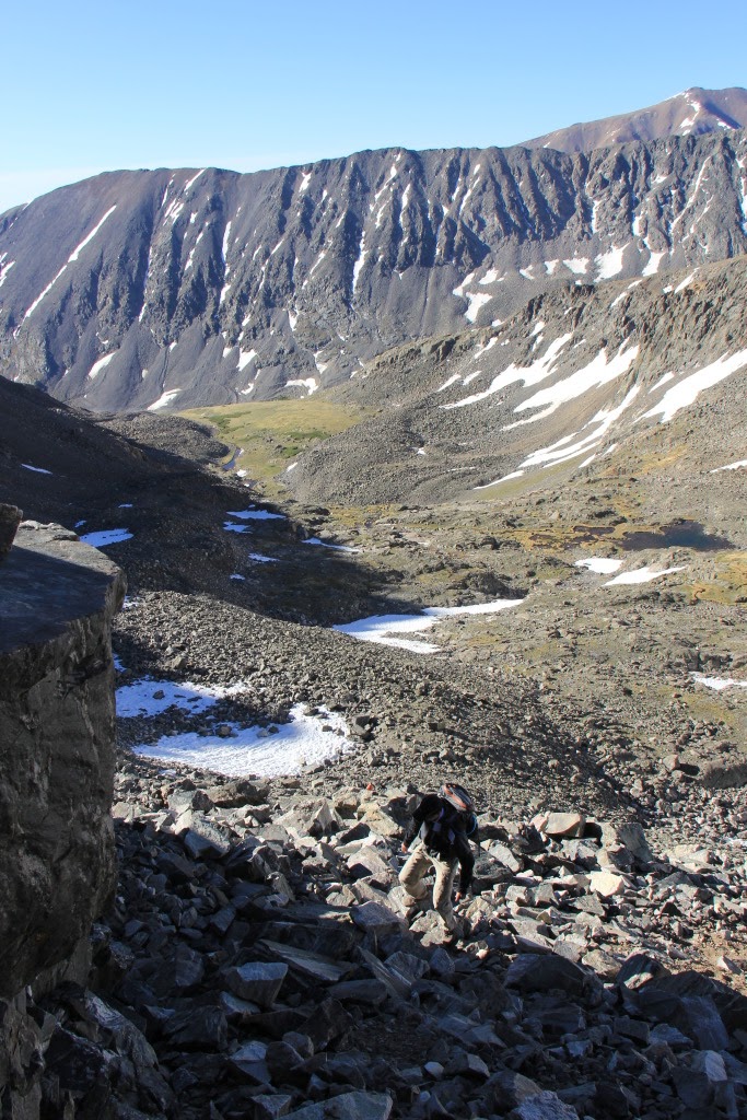
After working up the far side of the notch, the terrain eases up into more talus and tundra. I was beginning to feel the effects of the high elevation. My energy was waning, my head ached, and it felt like I should have already been at the top. But I was still having fun.

Nice views between the ridge and the summit

From the summit, at about 13224 feet (4030 meters), the views were great and the wind was whipping from the north. There are several wind breaks constructed from stone where I ducked down to rest and have a snack. It was 11:45 when I reached the top, and I was happy to have a jacket and warm hat in my backpack.

A view of the Indian Peaks and Upper Cooley Lake from the summit

From there, I took the trail back down. It was frequently doubling as a stream bed for the snow-melt. The trail makes its way through more wide-open tundra, and it was after 13:00 before I got below treeline.

Looking back at Audubon from the trail. The southeast ridge is on the left.

I saw several marmots among the talus, both before and after the summit. I have a pet cat named after the 17th-century Irish harper Turlough O'Carolan. I got to thinking that if I had a pet marmot, I would name it Thomas Talus. But I'm going to settle for giving that name to this one.

Thomas Talus, the Audubon marmot

It felt great to be hiking in Colorado's high country again. The Appalachians are nice, but this felt like home.

A cairn tells me that this where I'm supposed to be.

And of course, no discussion of Mount Audubon would be complete without some kind of word-play, so I'll leave you with this, which has been going through my head for the past few days.

Thursday, May 31, 2012

A Week on the AT

Some time last year I received a phone call from my father. My nephew S and he were driving around in North Carolina doing some sight-seeing in the Appalachians, and they had hiked to the top of one of the balds [1] out there. "You and S ought to come out here and do some hiking on the Appalachian Trail," he said.

"I'm in!" (I don't take a lot of convincing when it comes to invitations to adventure.)

I spent the winter doing research and planning the trip. S is attending university in Kentucky, so in addition to taking the weather into consideration, we had to schedule a time when he would not be in class. The break between Spring and Summer semesters offered the perfect time to make it happen.

My dad offered to provide logistics, ferrying us to the trail, after which he would stay in the town of Hot Springs, NC - at least until after we passed through - and then pick us up when we were done.

The goal was to spend one week on the trail, hoping to covering about 100 miles from Waterville School Road to Erwin, TN. Based on the mileage I was covering on my day hikes, that sounded attainable. Circumstances didn't entirely allow for it, but we did 77 miles (124 km), which we felt was pretty good. We put in on Sunday, May 20th, 2012, and left the trail on Saturday, May 26th.
Day 1: S and J, about to set out from Waterville School Road
This was my longest backpacking trip to date, and the first for S. It was absolutely amazing, and I think we both came away with a lot of good knowledge and experience and the inspiration to do more of it. A recount of the hike would be tedious, but here are a few things that I learned along the way.

The AT is a community

Upon setting foot on the trail, we were instantly immersed in a community of hikers. There were people from all parts of the country, from all walks of life, and with all sorts of goals. But we were bound together by the thread of the trail which wound its way through the forests and over the mountains of the Appalachians.

The AT must be one of the most heavily-traveled backcountry trails in the nation. We frequently hiked for several hours without seeing anyone, but there were always a few neighbors when we stopped at shelters for the night. We frequently found ourselves camping with the same folks for two or three nights in a row.

I've heard people say that they would enjoy hiking the AT, but would be unwilling to do it alone. My experience was that you're never really alone out there. They say that if you run into any kind of trouble, the best piece of equipment you can have is a deck of cards. That way you can keep yourself entertained while waiting for the next passer-by.
Day 5: A lush view from White Rock Cliff

Shelters are nice

The AT has shelters set up every 5 to 8 miles or so for housing hikers. We opted not to actually sleep in any of them, but we mostly camped next to them. The shelters of the AT are notorious for being visited by mice, and they lack any kind of shield from insects. But they have some nice peripheral features such as water sources, privies, picnic tables, and cables for suspending food out of reach of the local wildlife [2]. And they all had sites for pitching tents.
Day 3: Early morning at our camp site at Walnut Mountain Shelter
The only night we slept at an isolated camp site was on day 4. We had planned to bypass Spring Mountain shelter to get in a few extra miles, but found ourselves in a torrential downpour shortly after doing so. Had we known that it would rain that hard, we would have stayed in the shelter.

Go light

I've read plenty of times that carrying less weight will do more for your enjoyment of a backpacking trip than could be gained from most extra recreational items you might want to bring. This proved to be more true than I'd imagined. Especially with my plantar fasciitis giving me grief.

We heard many tales of through-hikers who had to jettison gear in the first days of their hike. One guy said he had to give a nice fishing rod away to somebody at a trail head parking lot. Another said he was given a samurai sword in exchange for cigarettes on some Georgia mountain top. Fortunately, meeting Dad in Hot Springs at the end of day 3 gave us an opportunity to drop some weight without losing anything permanently.
Day 4: Hot Springs, NC, and the French Broad River
Having the official AT map and guide book for our area was essential. But if I'd been thinking ahead, I would have transcribed or photo-copied the pages from the guide book for the sections we were hiking and left the book itself at home. That would have saved a fair amount of weight and bulk.

I hit the trail with three different knives! I had my Swiss Army pocketknife, a Leatherman, and a larger camp/bushcraft knife. When we met up with my dad in Hot Springs, I left all but the pocketknife with him. I would gladly have traded my 4-piece eating/cooking utensil set for one titanium spork. I also started out with a rain jacket, rain pants, and a warm puffy jacket. After HS, I just carried the rain jacket and used it during the chilly hours of the morning.

My DSLR camera didn't make the cut either. Photos from the second half of the trip were taken with my phone. Incidentally, I took more pictures that way than I did with the big camera simply because it was more convenient. A good compact point-and-shoot would have been the best option.

I can't go camping (nor otherwise get to sleep) without a book to read. This time it was book 1 of The Mongoliad, a collaborative work by several authors, including Neal Stephenson and Greg Bear. By the time I got home, I was well on my way to finishing it. But much of that progress was made on the return flight. I could have gotten by with a much smaller, lighter book on the trail.

Do your homework

As a vegan, I've become accustomed to mistrusting the availability of food at most small stores and restaurants. So I hit the trail with a full week's worth of food in my pack. It was by far the heaviest part of my load. If I'd known more about Hot Springs, I could have carried far less and resupplied half-way through the hike. Hot Springs has a Dollar General store with a good enough selection for most hikers. And there is a store which specializes in backpacking food where I could have gotten additional vegan items.

With a bit of research, I could probably also have figured out that much of the sun protection equipment I had with me was superfluous. I know it's part of the 10 Essentials, but the hat, sunglasses, and sunblock were all unnecessary beneath the canopy of trees that shades the vast majority of the miles through this region.

Tap water sucks

I'm not usually a water snob. And to be honest, my sense of smell and taste are usually pretty dull. But after a week without carbon monoxide or Sriracha, a week of drawing water from mountain streams and springs, civilization smelled pretty bad. Granted, I wasn't smelling like a bouquet of flowers, but at least it was a natural smell. After getting to a hotel room and showering, I was walking around in this choking cloud of perfumed soap fumes that I could almost see.

And the tap water... I can't believe how bad it was. It smelled of chlorine and made my tongue and the roof of my mouth go numb. 

Good stories don't always happen on the trail

Though he never set foot on the trail, my dad came away from the trip with plenty of good experiences and stories as well.

Within a few minutes of being on the trail, a woman passed by us going the opposite direction with her arm in a makeshift sling. The man with her said he believed her wrist was either broken or badly sprained. They were making for the Standing Bear hostel just up the road from where we were dropped off. My father had gone up there to kill some time, so he ended up giving her a ride to the nearest hospital, some 30 miles away.

During his time in Hot Springs, Dad hung out at the diner and other hiker haunts, talked to folks who were passing through, and gave some guys a ride when they needed it. He thoroughly enjoyed himself. And he also took in a soak in the mineral springs for which the town is named, followed by a massage.

----


[1] In the Appalachians, a bald is a mountain top whose summit is clear of trees. This isn't due to elevation, as would be the case here in the Rockies, but the exact cause isn't well understood. We saw signage which suggested it was done by Indians to aid in their hunting. See http://en.wikipedia.org/wiki/Appalachian_balds

[2] The Walnut Mountain shelter lacked a picnic table, and the privy was full to the point of unusability. Jerry Cabin Shelter had no privy. All of the other shelters we stayed at had those features.