Showing posts with label Wildlife. Show all posts

Thursday, July 5, 2012

Independence Days in the Indian Peaks Wilderness

The rest of my family has been out of town for a week and a half, now. C took the kids to visit their grandparents in Michigan. And with some extra time off work for the 4th of July, what better way to spend Independence Day than completely on one's own in the middle of the wilderness?

I'd been poring over my map of Indian Peaks Wilderness Area, hoping for a nice 3-day route to jump out at me. Part of what I saw there amid the contour lines and trail markings is going to have to remain a project for the future. But I was able to make most of it happen.

Tuesday morning I got up really early. Unnecessarily early, even for a hiking day. My camping permits had been secured. The cats were boarded at the vet. I had rigged up an automatic watering system for the planters on the deck. Our fish was in the care of our wonderful neighbors (along with emergency information, should I fail to show up to get the fish back). The house was ready to take care of itself for a few days. My backpack was ready to go. So even though I poked around quite a bit, I was out the door and on my way to the mountains pretty early.

Long Lake

I arrived at the Long Lake trail head in the Brainard Lake recreational area some time around 7:00. Donning my pack and trekking poles, I set out for Pawnee Lake, just beyond the like-named pass over the continental divide. It's a short hike, maybe 6 miles, but beautiful and sometimes strenuous. I still had much of the day before me when I got to my destination for the first night.

Pawnee Lake

Upon arrival at the lake, I met a guy named Joel who had camped there Monday night. It was his first time backpacking, and Nature initiated him into the ranks by drenching him with rain. Taking that information into account, I sought as well-protected a camp site as possible. It was of particular importance to me, as I brought only a tarp to serve as improvised shelter.

After sitting by the lake for a time, having a snack and studying my route for the next day, I scouted the area. Fortune smiled upon me, and a perfect place to bed down for the night peeked out at me from beneath a large rock outcropping.

My camp site for the night of July 3rd.

Having made my sleeping arrangements, I lazed around for the rest of the day, exploring around the lake, reading, resting. There were tons of wildflowers in bloom, and everything was absolutely gorgeous.

Columbines in bloom.

It did rain for a while that afternoon, but my equipment and I stayed perfectly dry in our natural cubby. It was surprisingly comfortable, too, if I laid in just the right way. I woke up the next morning feeling well-rested. While I cooked my breakfast, bats flitted about to catch the plentiful mosquitoes hatched in the marshy area just below my nest.

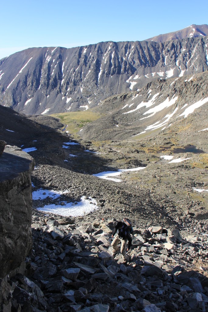
The hike back up Pawnee Pass was a fine eye-opener first thing in the morning, but I made it up without too much trouble. The west side of the pass is pretty bad, as far as maintained trails go. The rock near the top is unstable and likes to slide out from under you.

The west side of Pawnee Pass, being the notch just left of center.
A white-tailed ptarmigan on the trail west of Pawnee Pass

From the top of the pass, I headed north to Pawnee Peak. I encountered another hiker who had gotten an early start from the trail head that morning. He said he was going to go up Mount Toll before heading home, but he must have lingered on Pawnee for a while, because I didn't see him again after I left its summit.


The south ridge of Mt Toll, viewed from Pawnee Peak


The south ridge of Toll is a straight-forward hike. Nothing else about that mountain can make any such claim. I wasn't prepared to descend the north face, which probably would involve rappelling, but I had read about a so-called social trail that skirts the west side and brings you to the saddle between Toll and Paiute. My first attempt to find that trail was abortive. After making it part-way, the route dead-ended. So I went back to the ridge, descended a little more, and found an entrance to the "trail" marked with a cairn.


Entrance to the western traverse around Mt Toll. There is a hard-to-see cairn right in the middle of the notch.

I stowed my camera for the sometimes-harrowing descent down a steep, crumbling gully, so I don't have any more pictures of the route. At the bottom of the gully, I found reason to believe that if I had gone a bit farther down from Toll, there would have been a better way to get through the first part of the traverse. But note that I'm not really recommending this route to anyone. Even without a large backpack, it isn't really the safest place to be. But if you want to get from Toll to Paiute without technical climbing gear, it's really your only option.

Approximate route traversing the west face of Mt Toll. The blue route is the one I took. The green section is based on speculation. The red is a no-go.

From the saddle, I down-climbed the east side to avoid an ice sheet (yes, even in July), but it ended up causing me to lose more elevation than I'd hoped. I cursed myself for not just climbing up and over the prominence on the ridge, but going down seemed like the safer option at the time.

Paiute Peak, viewed from the south. When viewed full-sized, a hiker can be seen atop the left-hand part of the summit.

As I approached Paiute, I saw a small group of big-horned sheep, with two little lambs playing rambunctiously among the rocks. I went as slowly and quietly as I could, but they disappeared down the west face of the ridge before I got very close.

Bighorn sheep just south of Paiute Peak

It was only around noon by the time I got to Paiute's summit, but I was feeling drained. I certainly had no energy for scrambling around in places where a mistake would carry mortal consequences. Fortunately, the ridge between Paiute and Audubon is no such place. Relatively speaking, anyway. So I made my way up the west ridge and over to Audubon's west side, where I joined the trail I had descended the previous time I went up Audubon.

Audubon's west ridge, viewed from the south of Paiute

I passed a couple of hikers who were also descending - they wondered where I had come from, given that there was nobody on the summit when they left. And with it being past 14:00, I was a little surprised to see a handful of people on their way up the trail.

A cairn along Audubon trail. Things were much greener than when I was there in June.

It would have been easier for me to just follow the trail back to my truck, but that wouldn't be much fun. And anyway, I had a camping permit for two nights, and I didn't want to waste it. So I turned north where the Audubon and Beaver Creek trails intersect and made my way back into my designated camping zone. Probably 1.5 miles from there, just a little below tree line, I found a spot where a brook ran near the trail, and just up the hill there was a clearing in the spruce trees where I put up my shelter for the night.

My camp site for the night of July 4th.

It was an overcast night, but it didn't rain. The full moon shone through gaps in the clouds from time to time, but even when it wasn't visible, its light reflected off of the clouds and kept it from getting very dark. Even as exhausted as I was, it was a disappointingly wakeful night. But I kept forcing myself to go back to sleep until I woke for the last time at 5:00. Since it was such a short distance back to the trail head, I had thought that I would just hang out for a while and finish the book that I brought with me. But the clouds that had persisted through the night began to threaten rain, so after breakfast, I packed up and was on the trail at 6:40.

On my way down, just after the first switchback below the intersection with the Audubon trail, a large buck with velvet antlers bounded across the path. Apart from the sheep at Paiute, it was the first large animal I'd seen out there, so I snapped a few pictures before moving on.

A buck near the south end of Beaver Creek trail

I began to see the morning shift of hikers on their way up the mountain. And just before getting to the parking lot, the trees opened up for a last good view of Pawnee, Toll, and Audubon. A last view for this trip, anyway.

Pawnee, Toll, and Audubon

So that's how I spent my Independence day: hiking through some of the most beautiful wilderness anywhere, sleeping in a cave, summiting four of the named Indian Peaks. It was my first time camping without a tent, and while luck had plenty to do with its success, I think a tarp may be the way to go from now on. It was also my first field trial of a home-made alcohol stove (made from a cat-food tin) and wind screen (made from soda cans I found). Those also worked quite well.

When my nephew and I were on the Appalachian Trail back in May, one of the many conversations about food involved burritos. So I decided to see what I could do about making some burritos on the trail. This was also a pretty good success. Instant rice, dehydrated refried beans, and some whole-wheat tortillas I packed in a freezer bag with a poster board backing to keep them from getting crushed. The burritos could have benefited from some nutritional yeast sauce and salsa, but when you've worked up a major appetite hiking all day, such luxuries are hardly required.


View Indian Peaks, July 3 - 5, 2012 in a larger map

Saturday, June 16, 2012

West Ridge or East Ridge? It's not a Quandary.

"So here's the plan. We take a day off work so we can wake up at 3 in the morning, drive for a couple of hours, and be at the trail head around sunrise. There's an easy, straight-forward way up this mountain, but I found a much more difficult route we can take instead. Are you in?"

I know what you're thinking: when you put it that way, who could possibly say no? How, you're wondering, did you miss your natural calling by becoming a software engineer instead of a salesman?

Or maybe you're not thinking those things at all. But I'm lucky to know a few people whose personal sense of rationality meshes with my own reasonably well. And so the scheme was hatched for Jim, Shawn, and me to climb the West Ridge of Quandary Peak near Breckenridge, Colorado.

Quandary is known as one of the easiest of the 14ers. Its standard route, the East Ridge, is just a 6-mile hike along a gentle trail from the parking area to the summit. But as with my recent outing to Audubon, the path less traveled is often more rewarding. So we opted to ascend the West Ridge, which is 2 miles shorter but takes probably twice as long. And it's at least an order of magnitude more fun.


View 2012/06/14 06:30 Quandary in a larger map

Wednesday night, I didn't sleep very well. Maybe it was excitement. Maybe it was the knowledge that my alarm clock was going to go off in just a few hours. Maybe it was the steel-cut oats in the slow-cooker downstairs calling my name all night. But I woke up feeling good, had a quick but filling breakfast, and was out the door by 3:45 and at Shawn's house by 4.

We arrived at the rendezvous point - the Safeway in Frisco - a bit before Jim. The mountain air was a crisp 45 degrees, and I was smiling ear to ear as I went into a gas station for something to drink while we waited.

We left Jim's SUV at the main trail head, then rode together to park my truck at Blue Lakes. We geared up and hit the trail around 6:30.


We made our way up the gully above Blue Lakes toward the ridge.


Along the way, Shawn and I donned traction aids and pulled out our ice axes to ascend one of the few snow fields left after a winter of very little precipitation. Jim went around the snow and easily beat us to the top of that section. But as long as the two of us were hauling axes, we wanted to get a little use out of them, however superfluous.


Once we gained the ridge, the view to the north was spectacular.


It is also at this point that things started to get really fun. Pictures will do more justice to the experience than any words that I could craft.


Up and over via that scree-filled gully. One at a time to avoid rock-fall.


The climb up this section felt adventuresome.

This down-climb was more memorable than the climb up out
 of the notch which is considered the crux of the route.

Jim and Shawn at the bottom of the crux,
with the wall we just descended behind them.

Three intrepid hikers (and some other dude) at the summit.
When we arrived at the summit, there were several other hikers who had come up the East Ridge. They were the first people we had seen since parking the truck. The remainder of the hike down the standard route was pretty well populated, despite it being a week-day.

Looking back toward the summit from the East Ridge.

I was very gratified to see some mountain goats on our way down. Somehow I've missed them on all of my previous high-country hikes.


The goats ended up blocking the trail, and they were determined to stay on it. So eventually we had to circumnavigate their location so we could move on without herding them along the entire way. The remainder of the hike was pretty uneventful. We were glad to have two vehicles, else the 2-mile walk back up the road to Blue Lakes would have been a bit of a drag.

Back at the truck, we hung out for a while, enjoying a New Belgium Somersault ale on the tailgate. A couple more mountain goats arrived in the parking area, providing some entertainment by licking the tires of another vehicle that was parked nearby.


After Audubon and Quandary, I'm pretty certain that I'll have trouble being content with a Class 1 ascent of a mountain when there's a Class 3 or 4 available. And the entire experience definitely made the early start well worth it.


Monday, May 2, 2011

Lookout Mountain race postponed

The morning of Saturday, April 23, I went out to Golden to spend some time riding up Lookout Mountain in preparation for the race on the 30th. It was cold and snowy and generally unpleasant. So rather than the 2 or 3 times I thought I was going to do the climb, I just went up once. I even skipped the back-side loop on Paradise Road.

On the way back down I saw something I've never even heard of before: a black fox. From what I've read, it's just a red fox with a genetic mutation. They say it's more common in young foxes, and that they usually grow out of it. But this one was pretty big, so I believe it was a rarer adult specimen.

Anyway, I was all ajitter as I prepared for the race Saturday morning. The wind was quite blustery on the drive out, and the temperatures were cold. I tried to convince myself that the previous weekend's training effort was going to serve me well. But when I got to Golden, I found out that the race was postponed to a later date due to dangerously strong wind farther up the mountain.

It was pretty disappointing, but it wasn't quite as breezy and cold near my home, so I got out for a ride despite the weather conditions. The rest of the day was spent hanging out with the family, reading, napping, and shopping for groceries.

Sunday morning I got up and did an indoor workout on the trainer. I tried a new CTS video with some criterium-specific work in preparation for the Superior Morgul Classic coming up on Memorial Day weekend. I had planned to only do the road race, but a bundle package came up on Handlebargains (it's like Groupon for bike stuff), so I put aside my fear of fast cornering and signed up for both races. Anyway, that CTS workout is a butt-kicker. It was nice.

Thursday, July 22, 2010

More suburban wildlife

Bull snakes are quite common in Colorado, and this year there seem to be more than usual.  Earlier this week, I saw another one on the trail while riding to work.  It was probably around 4 feet long.

Bull snake on the bike trail

Bull snakes are pretty good to have around, though it can be alarming to come across one if you don't spot it soon enough.

This morning, as I sat drinking coffee, I saw a pair of foxes in my back yard.  They were pretty scrawny and were looking for food.  One of them came right up on the deck while the other stayed a little farther back.

A pair of foxes in my back yard

I had to chase them off so they wouldn't bother our cats.  I didn't know how they got into the yard, but I imagined having to open the gate to let them out.  That turns out to have been fairly naive, and as soon as I opened the back door, they had no trouble making their exit.  One leaped clear over the back fence, while the other scrambled through a gap where the fence is broken.

I had no idea that a fox could perch atop a fence like a cat.  But one of them did just that, once it got to the other side of my neighbor's yard.  It sat there watching me for quite a while.

Tuesday, May 25, 2010

Our eyes met, and we regarded each other curiously

I was riding to work this morning on a path which runs along a road that is closed for construction.  Suddenly something jumped up from the grass just a few feet away from me and ran into a copse of trees.  A fox?  No, too big: it was a coyote.

I went on a little way, got my camera, and doubled back to see if she was still there.


She certainly seemed just as curious about me as I was about her.  But we were both content to keep our distance.

I love being reminded - by flocks of geese in the autumn, fledgling red-tails in the spring - that this world is still a wild place.  And I love the opportunities that commuting by bike affords me to see so much of the world that is missed when viewed through a windshield.

[Edit, 2010-05-26]

By this morning the DOW had posted this sign nearby: