Sunday, June 27, 2010

Grand Canyon Bicycle Tour, Epilogue

Apology

This account has probably been somewhat more exhaustive than even people who like me pretty well are interested in reading.  But while researching the trip, I failed to find very much information on the Internet related to the routes I needed to take.  Many of the details were provided in the hope that what has been recorded here will prove useful to some fellow bicycle traveler in the future.

Getting Home

My family and I spent the next day touring the Canyon, and I took my daughter on a very short hike down Bright Angel trail.  My son and wife waited for us at the top.  On our way back up, we saw some mule deer.

On the Bright Angel trail

We were able to go back to the Tusayan ruins and see the museum.  While there, we also participated in an activity in which a park ranger taught us how to make split-twig figures.  These animal effigies were made by ancient canyon inhabitants and used in hunting rituals.

On Father's Day we left the Grand Canyon, retracing my route as far as Kayenta.  It was strange, after my slow trip by bicycle, to find myself hurtling along at terrific speeds through the desert.  West of Tuba City, we stopped at a dinosaur tracks site.  There we were guided by a Navajo woman and shown the footprints of several different types of dinosaurs.

In Kayenta, we headed north on US-163 into Utah.  This took us near Monument Valley and a number of other attractions.  The landscape was pretty impressive.

Near Monument Valley, Utah

That night we camped out near the town of Monticello, Utah, in the Manti-La Sal National Forest.  It was very nice there - much more green than I expected from the desert we had been driving through.  The dense undergrowth was home to many mule deer, and I saw one wild turkey hen.

Dalton Springs Campground, Manti-La Sal NF

The next morning we headed for Glenwood Springs, Colorado.  On the way, we stopped for lunch at the Moab Diner, and later visited a dinosaur museum in Fruita, Colorado.

Dinosaur museum in Fruita, Colorado

The overnight stay in Glenwood Springs was pleasant.  That evening we ate at the Glenwood Canyon Brewpub, and the next morning we spent an hour or two at the hot springs swimming pool.

The Rocky Mountains always make me feel like I'm coming home.  Usually when I return to Denver, whether travelling for work or to visit family, I'm coming from the east.  But even approaching from the Western Slopes, it felt great to be back in the familiar mountains of Colorado.  It was a beautiful drive along I-70 and it felt wonderful to be back home.

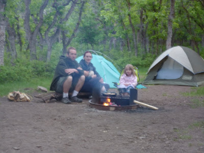
My family at the Grand Canyon

Retrospective

I was happy to discover that, of all of the equipment that I took with me which went unused, most of it was bike repair gear that I don't regret having packed.  The only thing that was really useless was my plate.  Since I wasn't cooking for more than just myself, it was much easier to eat out of the cookware.  There are enough cycle-touring packing lists published online already, but in the future I may decide to write about specific items that proved useful.

Riding through the desert wasn't nearly as bad as I thought it would be.  The air was dry and constantly moving over me while I rode, so my body's own temperature regulation did its job admirably.  The temperatures were frequently in the 90s, but I never felt hot while riding.  Still, plenty of water, electrolyte replacement drinks, and salty snacks were certain to have helped.

By all accounts, the "drunken Indian" warnings were legitimate, but not a problem for me.  The thing I'd been told to watch out for mostly were people driving drunk along the desert highways at night.  Since I wasn't riding after dark, there was no issue.  And I was told to make sure I was not visible from the road if camping in the desert, lest I be harassed by said drunken drivers.  This is a basic principle of stealth camping, but I had to admit that discouraging trespassers hardly seems like an unfair practice.

I went the entire trip without any mechanical problems to speak of.  Not even a flat tire.  Mysteriously, after we got home, my front tire went flat from a goathead even though I hadn't ridden it since it was stowed in our room at the lodge.  And naturally, my drive train was filthy.  I pulled the chain, cassette, chain rings, and idler/tension pulleys off and scrubbed everything down in the parts washer.  Now my bike is ready to take me to work on Monday.

Grand Canyon Bicycle Tour, Day 14

On the last day of my Grand Canyon Bicycle Tour, I woke early, had breakfast, and headed back to the rim to see the Canyon in the morning light.  There was a wildfire near the town of Williams to the south, so the air was somewhat hazy; and some clouds would have made for a better photographic opportunity.  It was still beautiful.

Grand Canyon at sunrise

I returned to my campsite to begin tearing things down and prepare to head to Grand Canyon Village.  While packing up my belongings, a man in his twenties from Zurich, Switzerland, stopped by to talk for a little bit.  Shortly thereafter, a slightly older man from Stuttgart, Germany, came by to chat.  The latter is a 30-km/day bicycle commuter and had flown into Tennessee before driving to Arizona.  They were both very nice, and I wondered if Europeans are generally interested in bicycle touring.  I did find it strange that I didn't see any other bike travelers at the park while I was there.

The 25 or so miles to Grand Canyon Village were pleasant, with many scenic overlooks and some Tusayan Indian ruins to serve as diversions.  The museum at the ruins opens at 9:00, so I wasn't able to go in there yet.  The road wasn't as flat as I had imagined it to be, but none of it posed any great difficulty.

A series of small walls at the Tusayan ruins

In time, I made it to the lodge where we had reservations for the next two nights.  Check-in time wasn't until 16:00, so I arranged to store my bicycle there until later.  During my ride through western New Mexico and Arizona, I'd had a couple of people ask if I was part of of some Ride or Cruise, variously, Across America.  I wasn't sure exactly what it was, but I had failed to cross its paths with the group, whatever it was.  The bellman at the lodge confirmed that it was the Race Across America, and I rather wish that I had been able to see them.

I had an early lunch at the lodge's cafeteria, and then set out for the Bright Angel trailhead, just a short walk away.  I wasn't prepared for a major hike, but I really wanted to get below the rim a little bit, and it was a great way to spend the time waiting for my family to arrive.  I only went as far as the first rest area, 1.5 miles in.  I then hiked back up the trail, maintaining a quick pace so that I'd at least feel like I'd had a decent workout.

Grand Canyon from 1.5 miles down Bright Angel trail

Looking back at Bright Angel Trail

After the hike, I wanted to see what else Grand Canyon Village had to offer, so I got on one of the free shuttles and rode to Market Plaza (ate more food) and the Visitors' Center.  I was still in my cycling clothes, and after the hike, I'm sure I was not the most pleasant neighbor to have on the bus.

By the time I made it back to the lodge, I only had to wait a few minutes before I was able to check in.  I dropped my bike off in the room, quickly changed clothes, and waited outside until my wife and kids drove up.  It was great to see them, and though I had talked to them pretty regularly over the course of the past two weeks, I felt like I had so much to tell them that I would never shut up.

View Larger Map

Grand Canyon Bicycle Tour, Day 13

After I got up and got things ready to go, I spent some time talking to the minister of the church which had served as my home the previous night.  We talked about their ministry with the Indians in the area - Hopi and Navajo - and a little bit about the traditional beliefs of those groups.  I was curious to discover whether the pacing native I saw from the ditch was performing some kind of ceremonial act.  What I was told was that if there was not a crowd, it was probably not an official ceremony.  Religion is a community practice for the Navajo.  But they sometimes say personal prayers to the four cardinal directions, and I think it's possible that this is what I observed.

Either that, or it's so boring in the desert that some people just walk back and forth for entertainment.  I wouldn't be surprised either way, I guess.

I got on the road around 7:00.  After a very short stint on US-89, I turned onto AZ-64.  This was one of the nicest roads I've ever ridden, as far as the quality of the pavement goes.  The shoulder was consistently nice and wide, well-paved, and clean.  And the ride was otherwise very pleasant as well.  It was all uphill, but the grade was not too severe: perhaps 5% most of the time, with a few short sections steeper than that.  And most importantly, there was only the gentlest of breezes.  The scenery was lovely, as the Little Colorado Gorge cuts dramatically into the plain of the desert.

Little Colorado Gorge seen from AZ-64

Kaibab National Forest would have been a nice place to camp, had I made it there at an appropriate time.  But while the climb up to GCNP was enjoyable first thing in the morning, it might be less pleasant at the end of a hard day of riding.

Entering Kaibab National Forest, south of GCNP

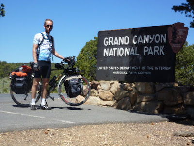
At last, at 11:45 I reached the Grand Canyon National Park.  It's difficult to tell from the photo that I took beside the sign, but I was positively beaming.  Oddly, the road's shoulder narrows upon entering the national park, but there wasn't too much traffic, and the riding was not bad.

Entering Grand Canyon National Park

I had heard that the National Park had a campground just for cyclists and hikers, but the gate attendant to whom I spoke didn't know anything about such a thing.  What she could tell me was that the campgrounds at Grand Canyon Village were full, but the first-come, first-serve sites at Desertview still had openings.  And it was right up the road from the gate.  I paid the $12 personal entry fee (it's $25 for a car) and went straight to the campground.  This was the first campground I'd seen with a self-service pay station which accepts credit cards, which was good news for me, since I didn't quite have enough cash to cover the $12/night fee.

As soon as I had things in order at the campsite (around 12:45), I headed for the canyon rim.  It was everything that I expected it would be.  I found a rock to sit on for a while, and as I reflected on everything I'd been through so that I could be in that very spot, I got a bit choked up.

Grand Canyon as seen from Desertview

I had lunch at the Desertview snack bar.  It was unsurprising, both in terms of price and the food selection.  But I had quite an appetite and had to keep a tight reign on myself to avoid grabbing one of everything.  I did grab one of each of the fresh fruits.  Fresh fruits and vegetables were rare while I was on the road.

Exploring the Grand Canyon

I'd been seeing a group of volunteer workers around Desertview and ended up talking to a couple of them.  They were removing noxious weeds from the area to help protect the native and less aggressive species.  There were also signs in place encouraging people to avoid bringing in non-native plants via seeds stuck in dirty shoes and vehicles.

After relaxing a bit around the campsite, I returned to the rim that evening for a sunset talk by one of the park rangers.  Ranger Elyssa, who is also a classical percussionist, spoke to us about soundscapes - the sum of all things audible in a given area - and how they should be treated as natural resources to be preserved just as we try to preserve the landscapes.  It was an enjoyable talk and included a performance of a movement from John Cage's 4'33" (a composition of ambient sound and no notes).

Grand Canyon in the evening light

I was absolutely thrilled to have reached my destination.  It was an excitement matched only by my anxiousness to see my family the next day.

View Larger Map

Grand Canyon Bicycle Tour, Day 12

I woke up in my room at the Anasazi Inn feeling refreshed and optimistic.  I had about 143 miles left to go, but my official plan was to make it to the Kaibab National Forest just south of Grand Canyon National Park.  The next day would then be an easy ride to Grand Canyon Village.  This was not to be.

Mornings had typically been calm, even if the wind picked up later in the day.  But by the time I got on the road, the wind was already blowing steadily out of the west.  It got worse throughout the day, until every pedal stroke was dogged by that incessant headwind.

I stopped at Elephant Feet, a rock formation near Tonalea/Red Lake.  There, some Navajo women had set up tables where they were selling beaded jewelry.  I talked to them for a little while and picked up some gifts for my wife and daughter.  A little way down the road, Tonalea has the only convenience store I recall seeing between Tsegi and Tuba City.

Elephant Feet near Tonalea, AZ

I had hoped to reach Tuba City around noon, but the going was slow and it turned out to be a little after 13:00 before I would arrive there.  Tuba City turns out to be an almost exact copy of Kayenta as far as services and restaurants are concerned.  There was another Pizza Edge there, but on this day, I decided to eat at a Chinese restaurant called the Golden Rice Bowl.  The food there wasn't great - roughly on par with Panda Express - and I got the feeling that I was interrupting the employees' social time.

I talked to my wife for a little bit before getting back on the road.  I was wary of riding farther in that wind, which was a sustained 20 miles per hour when I stopped for lunch.  But my wife affectionately told me to suck it up and get back out there.  Tired as I was, I still believed that I could make it to Kaibab that afternoon.

Leaving Tuba City turns out to be one of the worst decisions of the trip.  The other big mistake was failing to refill all of my water bottles before leaving.  I thought I had enough to make the 26 miles to Cameron.  The wind had picked up even more.  My progress was painfully slow, averaging somewhere around 7 miles per hour.  At one point I had to dismount and walk my bike for the first time on this trip: the wind just made it impossible to control my bike, and I was nearly blown into traffic.

Two hours later, after turning south from US-160 to US-89, I had to stop at a roadside native crafts stand and ask for some water to get me the rest of the way to Cameron.  A tourist customer there obliged me while the Navajo woman working there told me that Cameron was only 14 miles down the road, and I could get water there.  I told her that I knew that, but that it would still take me two hours to get there.  The extra water given to me there helped greatly, and having enough to drink was no longer one of my concerns on that stretch of road.

Junction of US-160 and US-89

The wind, on the other hand, continued to be my nemesis.  It became primarily a cross wind once I got onto US-89.  Through several stretches I was blasted by loose sand blowing across the road.  I had to dismount again, as the sandstorm was blinding me.  And the shoulder on this highway is very inconsistent.  Frequently it is narrow and half-occupied by a rumble strip.  I had to ride in the traffic lane, but the many tour buses and RVs didn't always want to make room for me.  Controlling my bike was a major struggle, and on several occasions I was inches away from being struck by a passing vehicle.

By the time I got to Cameron, I knew I needed to get off of the road for the day.  I think there is an RV park and lodge in town, but I didn't have much hope for there being any vacancies.  So I stopped by the local post office to inquire about churches in the town.  Somehow it is a time-honored tradition for churches to take in bicycle tourists, allowing them to pitch their tents on the church grounds for the night.  The post office was closed, but a local Navajo man came in to check his PO box.  I asked him about churches, and he offered to put my bike in the back of his truck and drive me to the nearest one.  It was only just up the road, but I gratefully accepted the offer.  Once the man figured out that all I really needed was a place to put up my tent, he said that I could have done so in his own yard.

I won't go into detail about exactly which church it was where I stayed - after all, they're trying to run a church, not a youth hostel.  But the minister and his wife were very kind, and I didn't feel like I was able to thank them enough for their hospitality.  I used the hose outside to rinse off as much of the sand from my skin as possible.  When it became evident that there was no place where my tent would be sheltered from the wind, the minister offered to let me sleep inside the church building.  The accommodations there were almost as nice as a motel, but that I had to sleep on the floor.  There was a bathroom where I was able to clean myself up a bit and a kitchen where I was able to prepare a hot supper.

Camping upstairs in a church

Treacherous as it was, I made good progress for the day - about 85 miles.  And even though I didn't quite make it to Kaibab, I had set myself up well for the following day's ride.

View Larger Map

Saturday, June 26, 2010

Grand Canyon Bicycle Tour, Day 11

Having slept in a ditch, it is no surprise that I didn't sleep late on this morning.  As usual, I woke just before sunrise, but I was not burdened with the normal responsibilities of tearing down my campsite.  Still not wanting to light a fire, I ate a meal replacement bar (I packed a couple for just such an occasion) and got on the road around 6:00.

It turns out I was a mile or so from a convenience store, so I stopped to get some coffee and some extra food and to refill on water.  Shortly thereafter, I crossed into Arizona.

Arizona state line, US-64

It should have been a great morning for riding.  The wind was calmer than usual, and the temperatures were mild.  But my legs felt stiff and sore.  I felt like I wasn't making good progress at all.  But I read somewhere that no matter what you feel like, on a long ride things will always change.  So I tried my best to ignore it and keep my mind occupied with my surroundings.

Red Mesa, AZ

It was somewhere around the Mexican Water Trading Post that I began to notice that the desert had taken on that famous rosy hue which earns it the "painted" moniker.  There were picturesque mesas and interesting formations along the road such as Baby Rocks.

Baby Rocks near Dennehotso, AZ

I was a few miles outside of Kayenta when a group of motorcyclists rode by.  One of them pumped his fist in the air as he passed.  A couple of miles down the road, they were stopped at a pull-off with a nice view of Church Rock.  They were watching me as I approached and waved to me, so I pulled in to chat.  They were from Littlerock, Arkansas, on their way to the north rim of the Grand Canyon, and really a genial group of guys and one lady.  They were quite interested in my bike and gear and were impressed by the journey I was making.  I was told that I would fit right in with the motorcycle crowd, since you have to be crazy to ride one.  As I took my leave and began to ride away, I overheard one of them say, "Now there goes a real man."  That made me feel pretty proud, especially as it had come from a Southern man in reference to someone wearing bicycle shorts.  They passed by once more, waving, and though I kept an eye out for them when I reached Kayenta at around 13:00, I didn't see them again.

Church Rock near Kayenta, AZ

I had seen on a map that Kayenta had a pizza restaurant, so I had my heart set on some pie.  There was a boarded-up building with a pizza sign out front, and I worried at first that I was out of luck.  But just behind that, in a shopping center, was Pizza Edge, fully operational and serving ice cream as well.  There was also a non-roaming phone signal in Kayenta, so I talked to my wife while I ate.  There were hotels in town, and I thought briefly about stopping there for the night.  But I wanted to get a few more miles in before I quit for the day.

I had heard that the Tsegi area, about 11 miles west of Kayenta, was supposed to have a campground, so that was my target.  But the only thing that anyone could tell me about was at the Navajo National Monument, another 19 miles down the road, 9 of which were off course and would have to be undone the next day.  I was tired, so I took a room at the Anasazi Inn.

That place was basically a pay-per-night trailer park, but that worked in my favor.  The room was half of a single-wide trailer and included a full kitchen.  The first order of business was to take a hot shower.  Then I was able to actually cook my ramen noodles and eat them, along with some packaged barbecue chicken, from a plate.  I felt very civilized.  I read for a little while and went to sleep as soon as it got dark.

My room at the Anasazi Inn, which defied photography

I put in over 90 miles that day, and so I was making up some of the lost time from the previous day's navigational mishap.

View Larger Map

Grand Canyon Bicycle Tour, Day 10

Packing up and leaving a motel is pretty much like packing up and leaving a campground.  My plan was to put in as many miles as possible each day and try to cover the remaining 280 or so miles across the desert in as little time as possible.  It wouldn't hurt anything to arrive a couple of days early at the Grand Canyon, and there didn't appear to be any reason to waste time sitting around, assuming I would be able to find a suitable place to sit.

I took Pinon Hills Blvd, which runs north of Farmington, to avoid the traffic and some construction on US-64.   There were a few hills along that route, but nothing too strenuous.  Pinon, or Road 6480 as it is called father west, terminates at the community of Kirtland, and Road 6500 quickly got me to the highway.  There were no signs indicating what US-64 was, so while it really couldn't be anything else, I checked my GPS just to be certain.

The ride to Shiprock was fairly nondescript, and I arrived around 11:00.  There is a large rock formation which is presumably the namesake of the town.

It doesn't much look like a ship to me.

Past Shiprock, I got onto some freshly paved tarmac and was making good time.  Unfortunately, I missed a turn in Shiprock where US-491 continues south and US-64 makes an insufficiently labeled turn (New Mexico doesn't seem keen on spending money on superfluous signs).  I was 25 miles off course by the time I realized what had happened.  All said, I rode an extra 50 miles and lost 4 or 5 hours due to that mistake.  Shortly after turning back, one of my water bladders fell off the back of my bike and cracked the cap.  I was feeling really angry, like nothing was going right.  But there was nothing to do but ride on.

US-491, south of Shiprock

Upon returning to Shiprock, I stopped for lunch.  I picked up some super-glue at a convenience store and did the best I could to fix the water bladder cap.  Then got back on track.  The US-64 turn is instead labelled San Francisco Parkway there in town.  There was a sign pointing toward Kayenta, AZ, but somehow I had missed it while looking for the highway number.

I had ridden right around 100 miles for the day and was in the middle of Navajo reservation land, nowhere near a proper campground or any other accommodations.  Eventually, around 18:45, I saw an area on the side of the road where there was a steep bank which was reasonably accessible.  It was low enough that headlights from passing cars would not shine on me.  I stopped and walked my bike down the bank and laid it over on its side.

My campsite below the guard rail on US-64

I did the best I could to make a meal down there in the ditch without drawing attention to myself.  My camp stove burns clean, but I would have had to move to a more exposed location to use it without running a risk of setting anything on fire.  I don't know if this fact is well-known or not, but ramen noodles to not require heat to prepare.  They had been a staple of my diet for most of the trip, and I never bothered to waste stove fuel cooking them.  You can just submerge the noodles in water for a while and they just soak it up.  Sure, they would probably taste better warm, but the choice of fare was strictly pragmatic in the first place.  So I ate and laid low, waiting for the sun to go down.

There are two types of plants in this world: those which are cultivated by humans and those which must fend for themselves.  My ditch was covered by the latter, mostly grasses.  The remarkable thing was that, although each one of them had developed a unique means of spreading its seeds, they all involved varying degrees and forms of discomfort to myself.  I had beggar's lice stuck to my clothes, sharp pods poking into my socks, and all manner of seeds sticking me in an effort to further their species.

I was sitting on my tarp, leaning against the bank with my bike below me.  As dusk began to fall, I noticed someone walking along a ridge just north of me.  At first I was concerned about being discovered, but whatever this person was doing, it didn't have anything to do with looking for bicycle tourists sleeping in the ditch.  He/she just paced back and forth across the length of the ridge.  I watched the walker against the graying sky until there was not enough light to see anymore.

This was the only night I slept outside of a tent or was otherwise enclosed.  It wasn't terribly comfortable - I had a pannier wedged under my backside to keep me from sliding down the hill - but it wasn't too bad.  The sky was clear and the stars were magnificent.  At one point I heard a rustling in the grass near my head, which ended up being what I assumed to be a small lizard which ran down my shirt.  But otherwise it was a quiet night.

View Larger Map

Not shown on the map is the extra 50 miles of wasted riding.  Even though it turned out to be the highest-mileage day of the whole trip, I didn't make nearly as much progress as I had hoped.

Grand Canyon Bicycle Tour, Days 8 and 9

I on the 8th day (Saturday), I woke to a warmer morning than I'd had farther north, but it was still cool and pleasant.  I packed up my gear and stopped by Josh's campsite for a cup of coffee before heading out.  My plan was to take NM-173 to Aztec rather than sticking to the original plan of going through Bloomfield, and then on to Farmington via NM-516.  I had been told that, while the terrain is more hilly, there is less oil traffic that way.

Right after leaving the state park around 9:00, I rode down the afore-mentioned dam.  Shortly thereafter, I saw a group of turkey vultures around a carcass - it was like a scene from a nature documentary, but difficult to photograph at that distance with my point-and-shoot camera.

Turkey vultures near NM-151

The Navajo Dam community, at the junction of NM-511 and NM-173, has some services as well as a bed-and-breakfast, but I didn't have any need to stop.  The ride to Aztec was pretty difficult, with more of the steep, rolling hills that I'd experienced the day before.  I came to the conclusion that, when laden with touring gear, I prefer long climbs over shorter, steeper ones.  The rollers through this area don't give the body enough time to adjust and fall into a good rhythm before the climb is over and you're descending again.  And the descents are always too short.

The desert along NM-173

The road goes ever on and on

Shortly after the junction with NM-575, a valley opens up and the climbing is essentially over.  I more-or-less coasted into Aztec and took a left onto US-550.  I stopped for lunch at the Aztec Restaurant, which boasted home-style cooking.  It was good fare, and I probably ate more than I needed.  It took a while for the food-induced drowsiness to wear off.

Traffic on NM-516 to Farmington was pretty heavy, and there wasn't a great shoulder.  But it turned out to be a very flat and quick ride.  In Pagosa Springs, I had been referred to the Cottonwood Cyclery, which I soon found right on the main strip as I entered Farmington.  I spoke to one of the employees there to get more information about where to stay in town and what to expect when riding through Arizona.  I then doubled back and got a room at the Super 8 motel, situated in an area with plenty of shopping options.

I had been asked before my trip started whether I would be staying at any motels along the way, or if it was going to be all camping.  My response was that I wasn't laying down any rules for the trip.  I would use motels if I needed to, or if I felt like getting a break from camping.  In this case, the decision was driven by both.  I had decided to take a rest day, and the motel offered enough comfort to get sufficient rest.  Also, I had developed some saddle sores and an aching hip.  The pool and hot tub at the motel gave me some much-needed recuperation.  And there aren't any campgrounds that I could discover in the Farmington or Shiprock areas anyway, so there wasn't much choice but to stay in a motel.

Farmington was the first town where I got a cell phone signal from my carrier, and I finally got data service.  I was able to catch up on the news and talk to my family a bit more than usual without racking up more roaming charges.  I got a microwave meal and some scotch from the grocery store and just relaxed for the rest of the evening.

Real beds feel so good.

The next day, Sunday, I walked to the Zia sporting goods store to see if I could find an extra water bladder to ensure that I was well-prepared for the remainder of the journey.  Even though I expected to be able to refill my water pretty frequently, I didn't want to take any chances.  There is also a Big 5 sporting goods store on that road, but Zia unsurprisingly turned out to have better camping equipment.  The walk turned out to be rather farther than I would have liked for a rest day (8 miles or so, round-trip), but it was nice to be off the bike and using different muscles for a while.

The motel provided a complementary breakfast, but on my way to Zia, I became quite hungry.  I thought I was going to stop at a fast-food restaurant for whatever egg-and-meat-on-bread offering they had, but then I saw a sign.  It was as though the heavens opened up and a ray of divine inspiration shone through the clouds: Golden Corral All You Can Eat Breakfast Buffet.  It was 10:30, so I didn't have much time until they switched to the lunch menu.  I made the most of the time I had and finished about four plates of food.  It was great.

Aside from that, Sunday involved sitting in the hot tub, watching stupid movies on television, taking inventory of my food, and making preparations for my departure the next day.

View Larger Map

Friday, June 25, 2010

Grand Canyon Bicycle Tour, Day 7

I got a good night's sleep at the Colorado end of Navajo Lake and woke up fairly early.  I wanted to get to the New Mexico end of the lake as early as I could, since it was Friday, and weekend campers would likely be filling the place up later in the day.

I continued on CO-151 to arrive at the town of Ignacio around 10:00, where I briefly turned north on CO-172 in search of second breakfast.  I found it at The Patio, a diner and evidently something of a bar.  It was farther up the road than I initially planned to go.  I had almost given up on finding an open restaurant and turned around when I noticed a parking lot full of trucks.  That's always a good sign.  I enjoyed a good meal and good service, though ironically, I sat at the diner counter rather than on the patio.  I had cell phone service there, so I called to check in with my family before turning south once more.

The Patio Restaurant, Ignacio, CO

It was around 11:15 that I crossed the state line into New Mexico.

New Mexico state line, CO-172/NM-511

Up to that point, the terrain had been relatively flat, but it almost at once became very hilly.  And there were few concessions made for tempering the grade.  The climbs, while short, were frequently 7% or so.  It was a very tiring day of riding.  The scenery was nice, though, and I got a good sampling of desert landscapes.

Desert scenery along NM-511

I arrived at Navajo Lake State Park, New Mexico, around 13:00 and stopped at the visitor's center to inquire about  the camp sites.  I was told that developed sites cost $10, but it is possible to camp anywhere else for $8.  I'm perfectly willing to pay $2 extra for a table, a clear tent pad, and easy access to water and restrooms.  I was also told that the Cedar campground was the only one with showers, so it was a no-brainer as to which of the three grounds I'd be using.

Navajo Lake near the park entrance on NM-511

It's worth noting that there are some services just past the state park entrance, but getting to them requires descending the Navajo Dam, which is quite steep.  Returning to the park would require a lot of effort, so when coming from the north, it is best to arrive equipped and save the shopping for the next day.

I got a good campsite right on the edge of the hill overlooking the lake.  None of the sites really had much shade, but I found a small patch to sit in while I ate my lunch.  Then, I made my way down the hill to the water's edge to explore and cool off in the water.

A lizard near the edge of Navajo Lake

Exploring the shoreline

After returning to camp, I was just sitting around when I was greeted by a friendly "Hello, brother!"  It was a bicycle traveler named Josh, who is making his way from Oregon to Florida.  He had been on the road since April and was expecting to reach the other end around October.  I invited him to come visit after he got settled into his own site, so soon we were chatting and sharing some laughs over the things we'd been through.  It was really good to meet another cycle tourist.

From a practical standpoint, I was lucky to meet him when I did because he had just covered much of the territory into which I'd be riding the following week.  He had come from the north rim of the Grand Canyon and rode about half of the route I had planned through Arizona, and basically all of it through New Mexico.  This was another instance in which a fellow cyclist was able to set my mind at ease concerning a part of the trip I feared most.  Just as the guy at Alpine in South Fork helped me gain confidence about Wolf Creek Pass, Josh had encouraging news about crossing the desert.  He assured me that there were services spaced no more than 40 or so miles apart through Arizona, and that it was much easier going than he'd expected.

A storm moved in that evening, and there was quite a display of lightening.  I was unnerved by my campsite's exposure there on the edge of the hill, but what trees there were showed no signs of lightning damage, so I tried not to worry too much.  Based on my experience from the first night of the trip, I did take the trouble to pull out my tarp and lash it over my tent to keep things dry.  Then I stood back and let the cool rain fall on me and headed to the shower once the storm had passed.  I was somewhat disappointed to find that, while they did not cost anything to use, the showers didn't have hot water.

My site at Cedar campground, Navajo Lake State Park, NM

As I anticipated, the campground did begin to fill up with folks moving in for the weekend.  I was worried that it might end up being too noisy, but as night fell, everyone was pretty respectful and kept it down enough that I was able to sleep without being disturbed.

View Larger Map

Grand Canyon Bicycle Tour, Day 6

It was a cold morning at the West Fork campground.  The surrounding mountains delay the rising of the sun, so that it didn't warm up as early as I would have liked.  I needed to do laundry before breaking camp, but I didn't want to get all wet and freeze my fingers.  So I spent some time taking inventory of my food and updating my journal.  That morning I built the only campfire I made for the whole trip, allowing me to stay warm while starting the laundry a little earlier than I would have done otherwise.

It was 10:00 by the time I got back on the road - the latest start I had since setting out.  It was a lovely ride down to Pagosa Springs.

US-160 between Wolf Creek Pass and Pagosa Springs

As I neared the town, I stopped by a gourmet food store called Choke Cherry East (there is a West counterpart on the other side of town).  They had lots of delicious-looking canned goods, but not much that I could carry on my bike.  And all of it was rather expensive.  I picked up some elk summer sausage.

The Junction Restaurant (just west of the junction of US-160  and US-84) was one of the first places I saw when entering Pagosa Springs, and they had an inviting patio where I could sit with some privacy (for talking on the phone) and fresh air (more for the sake of fellow patrons than for myself).  So around 11:30 I sat down to an early lunch.  The food was probably not the best that Pagosa Springs had to offer, but for a constantly-hungry bike traveler, it hit the spot.

While riding through town, I explored a little bit to see what was available in the way of a soak in the hot springs.  The only place I saw looked a bit run down and sketchy, so I decided to skip it.  There was a grocery store farther down the road where I stopped to restock my larder (i.e., the front-right pannier).

US-160 west of Pagosa Springs was very unpleasant, owing to the heavy traffic and shoulders which were at times too narrow.  I stopped briefly at a small bike shop in a shopping center a mile or two out of town (The Hub, I think it was).  There I talked to a guy who had lived in New Mexico and was familiar with the stretch of Arizona through which I'd be passing.  I received more warnings about "drunken Indians" and the scarcity of services along the route.  As you can see, the desert of Arizona was, after Wolf Creek Pass, the second of my major worries.

Grudgingly, I got back on the road.  The headwind had not let up, and there was an unsettling number of dead elk and deer in the ditch along the highway.  They were as common as prairie dogs back home.  Eventually, Chimney Rock came into view, and soon thereafter, my turn onto CO-151.

Chimney Rock, as seen from US-160

There was very little traffic as I traveled through the Ute reservation on CO-151.  But it was a Thursday, and I imagine that weekend traffic to Navajo Lake would be significantly heavier.  It was pretty nice going, with no major climbs, and the wind wasn't so bad since it wasn't straight on.

The Ute Reservation on CO-151

Around 17:30 I stopped at a convenience store in the town of Arboles, where the entrance to the Navajo State Park is located.  A ranger there told me that the thing to do was to secure a tent site at the Rosa campground within the park.  And as a fellow cyclist, he felt that it bore mentioning that there were showers there.  I couldn't believe it - it sounded like a tremendous luxury.

The tent sites at Rosa did not disappoint, and at $6 per night, it was one of the cheapest campgrounds I'd seen.  When I checked in at the visitor's center, I found that the best spot (on a promontory overlooking the marina) was taken, so I got the site right next to it, which was still overlooking the lake and had a very nice view.  I was worried at first that my neighbors and I might feel a bit crowded, but the campground nearly filled up over the course of the afternoon, so choosing a non-adjacent spot would have been pointless.

Rosa campsite, Navajo State Park

And as it turns out, the lovely family from Aspen on the promontory were the nicest camping neighbors one could hope for.  They had passed me on the highway some hours before, so they knew I'd had quite a day of riding.  The father of the family offered me a beer soon after I arrived.  I gratefully accepted the offer, along with some snap peas and string cheese his wife produced from the cooler.  Later, I visited with them at their camp site over another beer.  I was thankful for the company, but did not want to interfere too much with their family time.  I felt very lucky to have met such nice folks, and it was nice to see a family spending some quality time together like that.

While at the visitor's center, I asked the attendant whether or not I was still in bear country.  She said that I was not.  "What do I have to be afraid of, then?" I asked.  Mosquitoes, it turns out, were the worst that Navajo Lake had to offer.  But it was pretty breezy most of the evening, so aside from a brief surge of insects around dusk, they were not that big of a deal.

The campground at Navajo Lake is mostly set up for people with boats and campers.  That is a whole different type of camping, and I was amazed to see some of the amenities that they brought with them (one had a television satellite dish).  It was like packing up the better part of an entire house and bringing it along.

Boats docked for the night on Navajo Lake

The bathrooms at Rosa were very nice, with hot showers for $1 for four minutes.  And there were coin-operated laundry facilities with a big sink (not coin-operated) for hand-washing clothes.  There were electrical outlets which could be used for recharging batteries, etc.  I was able to get myself and most of my clothing clean for the first time.  It felt great.


Thursday, June 24, 2010

Grand Canyon Bicycle Tour, Day 5

While I had a dream about a bear coming to the door of my tent, I spent the night at Penitente Canyon being entirely uneaten.  My food remained uneaten as well, until I woke up and retrieved it.  After tearing down my camp, I rode back to the water well to fill up my bottles, rinse out my clothes, and wash my hair.

A word about laundry on a bike tour: clothing is bulky, and the weight adds up quickly.  So the entirety of my wardrobe consisted of two sets of riding clothes and two sets of camp clothes.  The latter included swimming trunks.  Ideally, one is able to change into camp clothes after stopping for the day, wash that day's riding clothes, and hang them up to dry overnight.  But frequently what I had to do was to wash my riding clothes the next morning and strap them on top of my panniers to dry while I rode.  And "washing" ranges anywhere from a proper wash in a sink with soap, bringing the clothes into a shower, or just rinsing them out as well as can be done in a stream on the side of the road.

I headed south on County Road 38A, which is not at all paved, and at times the gravel was deep enough to make my 28-mm tires sink in and nearly send me toppling.  But I think it was better than back-tracking to US-285.

County Road 38A

After a while, I emerged onto CO-112 just northeast of Del Norte.  As I neared town, I passed by a bison farm.

Bison near Del Norte

Then I crossed the Rio Grande for the only time on this trip.

The Rio Grande, just east of Del Norte

I arrived in Del Norte shortly before 10:00 and turned onto US-160.  While riding down this main street of the town, I asked an elderly lady where the best breakfast in town could be had.  She told me that Boogie's, just a block or so down the road, had the best breakfast anywhere in the area.  This is another recurring theme during my trip.  Essentially every morning I had instant oatmeal before setting out.  So I made a habit of having second breakfast as soon as circumstances allowed.  I had no basis for comparison to determine whether Boogie's was the best breakfast around, but it was certainly a tasty meal.  There was a hose spigot in the front of the building, so after eating, I used it to fill up my water bottles (replacing some of the well water from Penitente).  I called my wife and talked for a little bit before getting back on the road.

Wolf Creek Pass was one of two obstacles on my journey which had me genuinely concerned.  Friends had told me about it before I set out.  A lady in front of Boogie's warned me about the steep grades and urged me to take frequent breaks during the climb.  Its summit would be the highest elevation I would reach on my journey.  In short, I was already afraid of it.  As I left Del Norte, a strong headwind out of the west picked up and I knew that the psychological battle for Wolf Creek Pass had begun.  I recited my Litany Against an Evil Wind (All cyclists have one of those, don't they?) and pressed on toward South Fork.

Just before South Fork, there is a small shop called Alpine Bike and Ski where I decided to pop in and look around a bit.  This place is run by a young family and, along with mountain-biking accessories or ski gear, according to the season, they offer rafting trips.  They have been in business for about three years now, and the place has a lot of potential.  If you ever find yourself in South Fork for outdoor sports of any kind, I encourage you to stop in and give them some business.  My hands have had some numbness problems, so I picked up a new pair of gloves.  After talking to the owner a bit, he went out to take a look at my bike.  He made some adjustments to the angle of my handlebars to help relieve some of the pressure from my wrists, free of charge.

More importantly, he gave me some more concrete information about Wolf Creek Pass.  The wind might be a bit of an issue, he told me, but the grade was only 5% or 6%, and it wasn't really all that bad.  It allayed my fears, and I planned to make for Big Meadows campground, just before the climbing would start in earnest.  There I would make my base camp and prepare for the final assault the next morning.

But before leaving South Fork, I had to eat.  So on a recommendation I got at Alpine, I stopped just up the road at The Shaft restaurant for some lunch.  There I ordered and quickly consumed a barbecue beef sandwich of the same name.  I smiled to imagine myself saying to the waitress, "I'd like you to give me The Shaft, please."

The wind persisted as the highway angled southward, but the scenery heading up the pass was very beautiful.  I set an easy pace and looked forward to a restful afternoon before the climb that awaited me in the morning.  Along the way, I stopped at several pull-offs to rest and enjoy the sights.

The river beside US-160 going up Wolf Creek Pass

Around 16:00, another blow in the battle for Wolf Creek Pass was struck.  I reached the turn-off for Big Meadows and rode up a gravel road quite a way to the campground.  When I arrived, there was a sign stating that the campground was closed for dead tree removal.  I was pretty angry that they hadn't posted a sign at the highway.  But the area was quite pretty, so I stopped for a few minutes at the reservoir to eat a snack and dip my feet into the cold water.  While sitting there, I decided that the only course of action was to launch a sneak counter-attack and take on The Pass immediately.

Big Meadows Reservoir

By 17:45 I had reached the summit and stopped to take a picture at the sign marking the Continental Divide.  As I was doing so, a family from Florida pulled up in a big white truck.  The man got out and offered me some cold water from his cooler.  I declined, as I still had plenty of water.  Then he offered me a beer, saying that as a former cyclist, he knew that I'd just had a major accomplishment and should mark the occasion.  I couldn't say no, so soon I was sitting on the edge of the Divide marker drinking a Modelo Negro.  It was the first beer I'd had since setting out and possibly the best beer I've ever had.

Wolf Creek Pass: conquered.

Once the descent began, a spectacular view of the valley beyond opens up.  Compounded with the joy of cruising downhill at 30 miles per hour, it was nothing less than inspiring.

The valley beyond Wolf Creek Pass

I stopped at the main scenic overlook on the south side of the pass, where I met a bicycle traveler heading north.  He was a younger guy who had come from California to Durango with some friends and was heading on to Denver on his own.  He was riding a mountain bike and had very minimal gear.  He looked wiped out, having made it most of the way up the steep side of the pass already.  We chatted for a few minutes, but time was short, as it was getting late and we both needed to find camping before dark.  After we went our separate ways, it occurred to me that I should have made sure he had plenty of food and water.  Failing to do that was one of the only regrets I had during the whole trip.

West Fork is the first campground I came to after crossing the pass, and it was there that I stopped for the night.  Everything was so verdant, especially in comparison to the desert campsite I had the night before.  I didn't have much time to do more than eat and set up camp, but I was feeling great.  I had won the battle for Wolf Creek Pass.


Incidentally, my daughter had told me many times that I needed to watch out so as not to be eaten by the wolves on that pass.  Having seen a sign about it at the summit, I was able to tell her that it was named after a fellow by the last name of Wolf, and that I had been in no danger.  Both she and I were most relieved that I remained uneaten.

View Larger Map